


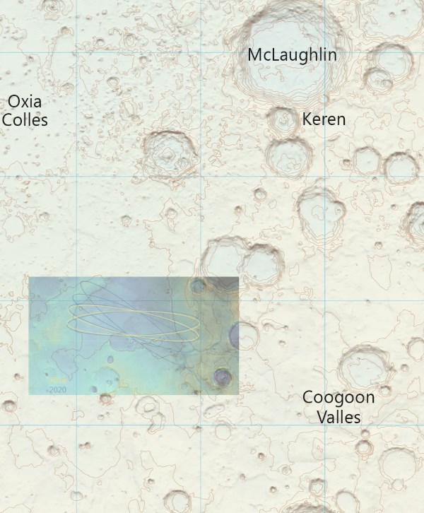
The Ordnance Survey (national mapping agency for the UK) has just released their first map of a region on another planet. It's a high resolution relief shaded contour map, and includes the area of Mars where ExoMars will land in 2018. Here is a close up view of it with the ESA landing ellipse in Oxia Planum superimposed.
Preview of the full map - low resolution, again with landing ellipse.
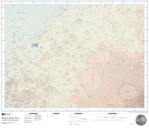
The full resolution image of the map plus landing ellipse is here. I've jpeg compressed it from 67.2 megabytes to under 20 megabytes for easier download - but with no jpeg artifacts as far as I can see. It's 11574 by 9921 pixels or 114,825,654 pixels or 114.826 mega pixels
Landing ellipse from Landing Ellipse Recommended for ExoMars in 2018.
And map (released by the Ordnance Survey under creative commons license)from their Flickr stream here.
The map was made by the cartographer Chris Wesson, and covers about 10 million square kilometers, or about 7% of the surface area of Mars. He was asked to do it by Dr Peter Grindrod, of Birbeck college, University of London.
See also the BBC news story Ordnance Survey releases digital map of Mars surface
The earlier ESA countour maps of Mars were photographs from orbit with countours automatically generated and superimposed. See Want to Hike on Mars? (high resolution images of these auto generated countour maps available here).
And for some background on the ESA ExoMars landing site Oxia Planum and some of the other sites they considered and more generally, sites of interest for the search for life on Mars, especially past life, see my Where Should we Send our Rovers to Mars to Unravel Mystery of Origin of First Living Cells?
MORE ONLINE POSTS AND LINK TO MY AUTHOR'S PAGE
And you might like my other posts on Quora

Robert Walker's posts - on Quora
And on Science20

Robert Walker's posts on Science20
KINDLE BOOKSHELF ON MY AUTHOR'S PAGE
And I have many other booklets on my kindle bookshelf


Comments