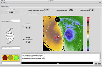
A new technique that helps forecasters continuously monitor landfalling hurricanes, giving them frequent and detailed images of a storm's location, will be implemented this summer.
The new system, developed by researchers at the National Center for Atmospheric Research (NCAR) in Boulder, Colo., and the Naval Research Laboratory (NRL) in Washington, D.C., will be implemented at the National Hurricane Center (NHC).
The technique, known as VORTRAC (Vortex Objective Radar Tracking and Circulation), was successfully tested by the hurricane center last year. The system, which relies on existing Doppler radars along the U.S. coast, provides details on hurricane winds and central pressure every six minutes, indicating whether the storm is gathering strength in the final hours before reaching shore.
