


Plenty of sun and some ice for water sounds like a lovely place for a moon base, doesn't it?
Three-dimensional views of the mountainous terrain surrounding a “peak of eternal light” near the Moon’s south pole have been released by the European Space Agency. Dr Detlef Koschny will present the images at the European Planetary Science Congress in Münster on Friday 26th September. Images taken by the AMIE camera carried by ESA’s SMART-1 mission have been used to create digital elevation model of the peak, which is almost continuously exposed to sunlight.
“AMIE is not a stereo camera, so producing a 3-D model of the surface has been a challenge,” said Dr Koschny. “We’ve used a technique where we use the brightness of reflected light to determine the slope and, by comparing several images, put together a model that produces a shadow pattern that matches those observed by SMART-1.”
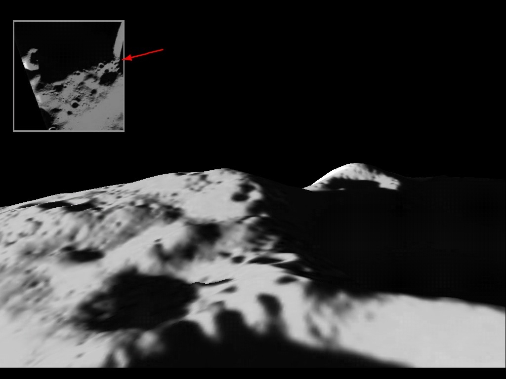
AMIE took a total of 113 images of the peak, located close to the rim of the Shackleton Crater which lies on the lunar south pole. In all but four of the images, the peak was illuminated by sunlight. This is of particular interest in planning future manned missions to the Moon, as it would mean that solar panels could be used almost constantly to generate an electricity supply for a lunar base.
In addition, the shadowed craters nearby are in constant darkness and may hold water ice deposited over millennia by cometary impacts and hydrogen and oxygen particles contained in the solar wind. This potential water supply would also be a vital resource for any lunar base.

The team, led by Dr Björn Grieger of ESA’s European Space Astronomy Centre in Madrid, selected five of the AMIE images showing the peak illuminated from different angles. They mapped all the pixels onto a grid, defining the bright and dark areas. The data from the five images were then compared to produce estimates of the slope angles and the rendered elevation model was iteratively adjusted to produce a shadow match. The original AMIE images were then projected onto the retrieved model. To clearly visualise the topography, the elevation has been exaggerated five times.
SMART-1 orbited the Moon between November 2004 and September 2006, covering a full seasonal cycle.


Comments