If Google is hoarding all of the information in the world, I want in on some of it. Lured by the siren song of the new ocean features in Google Earth 5, I took the plunge. Embarked upon my maiden voyage. Threw myself in with the sharks. Ran out of sea cliches. Downloaded Google 5 in all of its beta-riffic glory.
I turned to their user guide, hoping to take the software for a proper spin through their “Five Cool Easy Things You Can Do In Google Earth”. Google’s cool thing the first: Find your location. Um, Goog? I can see my house from here. No need to check out my unruly lawn from space. Let’s skip it. Cool thing the second: Get driving directions? Really. I already have a Google product for that, and it doesn’t do suspicious things on my hard drive.
For the benefit of the other Google Earth novices out there, I’ve compiled my own list.
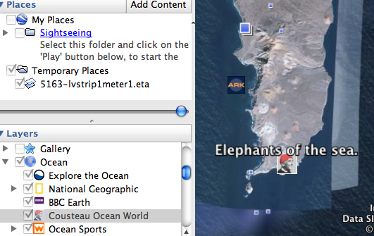
1. Follow Jacques Cousteau’s Little Red Watchcap
For my money, the “Layers” feature is the quickest way to have yourself some edutainment. You can find the layers menu in the bottom-left of the GE5 screen. Checking off the various boxes and looking for the results on the map is a cheap way to wring trivia out of GE5.
As an introduction, try Layers>Ocean>Cousteau Ocean World. You’ll see little pictures of Jacques Cousteau on the map, alerting you to the locations of le Commandant’s ocean adventures. Clicking on the icon brings up a description and a YouTube video.
2. Visit An Unreachable Monument (And Other One-Stop Shipwreck Shopping)
Since the tender age of eleven, it has bothered me that the Titanic has been designated a monument yet nobody can go see it. Google Earth is as close as we'll get.
I concur with this cnet review; you’ll never get anywhere by typing “Titanic” into the search field. It’s much easier to find it by first activating the Ocean>Shipwrecks layer and looking for the ship icon around 41N, 49W. You can roll over other ship icons to check out other shipwrecks, as well. (Sorry, pirates. Teh Goog doesn’t yet have the location of the HMS Victory for your plundering convenience.)
Titanic-Titanic.com provides a broader view of the Titanic’s timeline and history through Google Earth. Clicking on any of the locations on the page downloads a .kmz file. If you click on any downloaded .kmz file with Google Earth open, it’ll place a thumbtack and a label at the given location. I stopped short of the extensive catalog of Titanic victim cemetaries.
3. Stalk Some Monkeys
When Meerkat Manor just isn’t enough, there’s plenty of soap opera satisfaction in the Jane Goodall Institute’s Gombe chimpanzee colony. To activate the location of the chimps and the site of related blog posts, check off Layers>Global Awareness>Jane Goodall’s Gombe Chimpanzee Blog. The results will appear as a bunch of yellow binoculars and chimp profile icons, many concentrated around coordinates 4 S 29 E.
You can access the chronological version on the web, but there’s something satisfying about viewing the events spatially, as if you are an omniscient eye looking down into the lives of mortals. Or like you’re playing The Sims.
4. Depress Yourself By Creating A Map Of Doom.
Just a few of the pessimistic options available:
Layers>Global Awareness>USHMM: Crisis in DarfurCrisis in Darfur. If you search for Darfur, it will take you right to the pertinent part of the globe.
Layers>Global Awareness> Dead Zones. Look for fish skeletons along the coast.
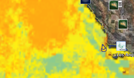
State of the ocean> Human Impacts. Find a white square icon on the map. (I found one on the coast of Southern CA. What are they trying to say about Hollywood?) A window appears prompting you to download a map overlay. It loads automatically.
Don’t worry, it won’t be there when next you load the program. Which is a good thing, because it turns your oceans a pre-apocalyptic shade of orange.
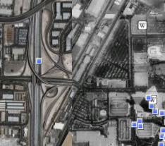
5. Cheer Yourself Up With A Trip To Vegas
This thread has a number of historic overlays for you to download, so you can take a look at the strip’s history from above. Download .kml files, click on them with Google Earth open, and they should automaticaly load in Google Earth. Las Vegas’ map is especially well-documented in pictures from both the past and the present, and these aerial views of the strip are significantly easier on the wallet than, say, a room in the Stratosphere.