Banner
You Didn't Feel Continental Mantle Earthquakes, But They Happened. A Lot

A 1979 seismic event was a different kind of earthquake, and it is has intrigued scientists ever...

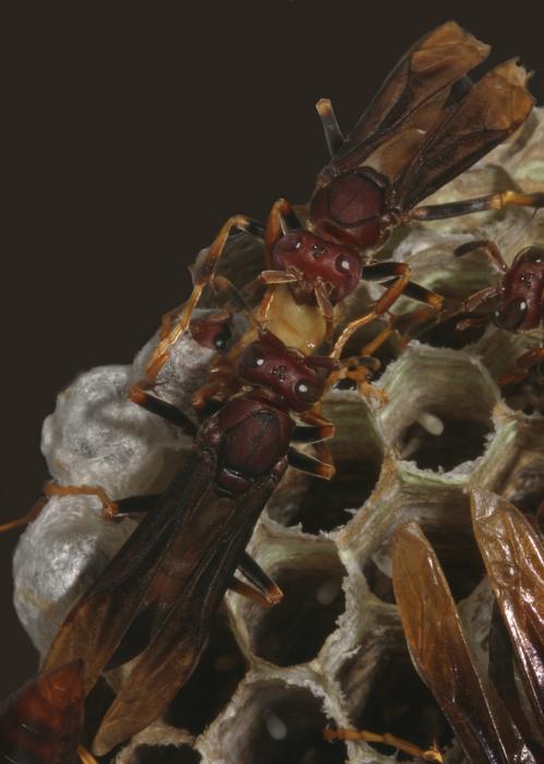
How To Overcome Leadership Battles

In times of social rancor and strife, most will fight each other, but societies are saved by those...

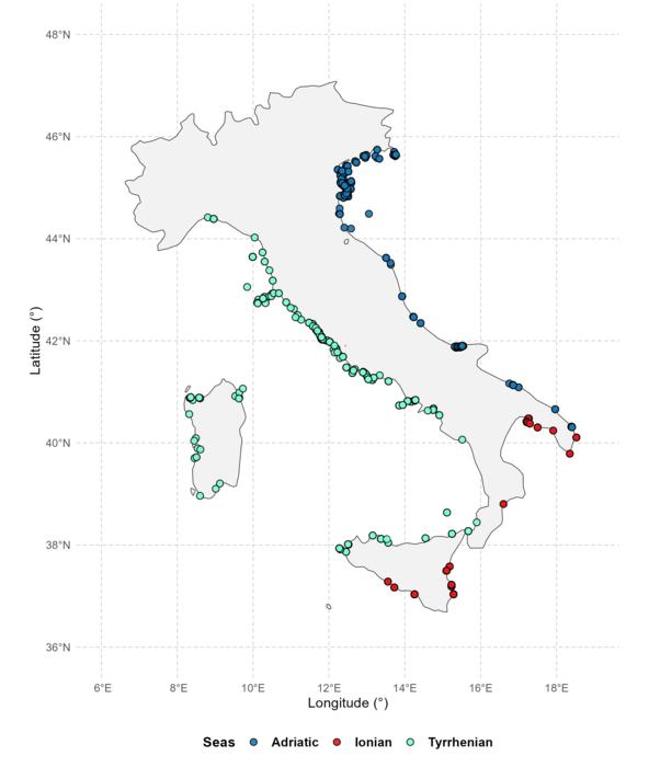
Thousands Of Unpublished Studies Show Why Conservation Efforts Miss The Mark

Europe alone has so much unpublished, un-catalogued biological data that it is challenging to take...

Why Antarctic Sea Ice Stopped Growing In 2015

Though numerical models and popular films like An Inconvenient Truth projected Arctic ice...

User picture.
News StaffRSS Feed of this column.

News Releases From All Over The World, Right To You... Read More »

Blogroll

A new imaging technique developed at MIT has allowed scientists to create the first 3D images of a living cell, using a method similar to the X-ray CT scans doctors use to see inside the body.

The technique, described in a paper published in the Aug. 12 online edition of Nature Methods, could be used to produce the most detailed images yet of what goes on inside a living cell without the help of fluorescent markers or other externally added contrast agents, said Michael Feld, director of MIT's George R. Harrison Spectroscopy Laboratory and a professor of physics.

"Accomplishing this has been my dream, and a goal of our laboratory, for several years," said Feld, senior author of the paper.

Last weeks's M 7.6 West Java earthquake was detected, located and sized after only 4 minutes and 38 seconds by the German Tsunami Early Warning System (GITEWS) currently under construction in Indonesia. The location of the earthquake has been established after just 2 minutes and 11 seconds. For comparison: The Pacific Tsunami Warning Center (PTWC) in Hawaii published the location and magnitude of this earthquake after about 17 minutes.

Such a rapid analysis was possible due to the new software system called "SeisComP" (Seismological Communication Processor) developed by GFZ Potsdam that was installed at the Meteorological and Geophysical Agency of Indonesia (BMG) in Jakarta, in the last weeks.

Scientists at Keele University in Staffordshire have questioned the safety of aluminium added to sunscreens and sunblocks.

The researchers, Scott Nicholson and Dr. Christopher Exley, measured the aluminium content of sunscreens/sunblocks, which either include or do not include an aluminium salt (for example, aluminium hydroxide, aluminium oxide, aluminium silicate, aluminium stearate, aluminium starch octenylsuccinate) as an ingredient.

Aluminium was present in all seven products tested and its content was of particular significance in three products, each of which listed it as an ingredient.

Aircraft engines are more efficient at higher temperatures, but this requires thermal treatment of engine components at very specific high temperatures in excess of 1300 °C. If the heat treatment temperature deviates too much from the optimal temperature, the treatment may be inadequate.

Thermocouples are calibrated using materials with known melting points (fixed points), but the available reference materials in the region of the very high temperatures required to treat jet engine components have a large uncertainty compared with the lower temperature fixed points.

Now measurement scientists at the National Physical Laboratory (NPL) have reduced the uncertainty of thermocouple temperature sensors at high temperatures to within a degree.

Scientists from the Desert Research Institute (DRI) and their collaborators have determined that Northern Hemisphere industrial pollution resulted in a seven-fold increase in black carbon (soot) in Arctic snow during the late 19th and early 20th centuries, according to new research into the impact of black carbon on Arctic climate forcing.

The study in the August 9th online edition of Science magazine was led by Drs. Joe McConnell and Ross Edwards – two ice core scientists from DRI – who used a new method for measuring soot in snow and ice to evaluate historical changes in soot concentrations using an ice core from the Greenland Ice Sheet.

A new regional study shows that land-use policies in Peru have been key to tempering rain forest degradation and destruction in that country. Scientists at the Carnegie Institution’s Department of Global Ecology led an international effort to analyze seven years of high-resolution satellite data covering most (79%) of the Peruvian Amazon for their findings. The work is published in the August 9, 2007, on-line edition of Science Express.

The scientists found that the government’s program of designating specific regions for legal logging, combined with protection of other forests, and the establishment of territories for indigenous peoples helped keep large-scale rain forest damage in check between the years 1999 and 2005.