


That has changed - for the first time reliable calculations of the future development of glaciers and their contributions to regional hydrology and global sea-level rise can be derived from an accurate measurement.
The international team mapped all of the world’s glaciers so all glaciologists can study the impacts of a changing climate on glaciers worldwide, and determine their total extent and volume on a glacier-by-glacier basis. Overall, glaciers cover an area of about 730,000 km2 and have a volume of about 170,000 km3.
The team found nearly 200,000 of them but that is actually less important - the number constantly changes due to disappearing small and fragmenting larger glaciers. More importantly, each glacier in the new inventory is represented by a computer-readable outline, making precise modelling of glacier–climate interactions much easier.
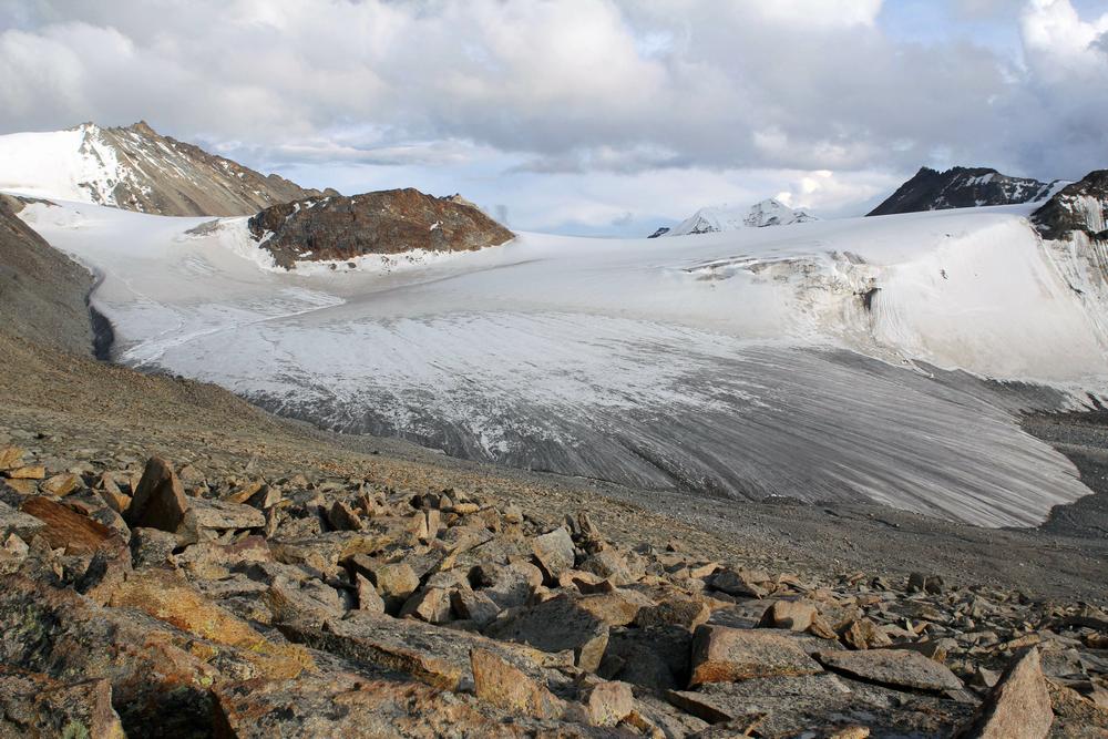
Don't get too attached to this picture. Glaciers are always growing, shrinking, being born and disappearing. This is the Zhadang glacier south of lake Nam Tso on the nortern ridge of the Nyainqentanglha mountain range in Tibet. Photo: Tino Pieczonka, TU Dresden
“This boost to the infrastructure means that people can now do research that they simply couldn’t do properly before,” said Graham Cogley of Trent University, one of the coordinators of the new Randolph Glacier Inventory (RGI), which is named after one of the group’s meeting places in New Hampshire.
The main stimulus for completing the inventory was the recently-published Fifth Assessment of the Intergovernmental Panel on Climate Change (IPCC) - it has already been published even though the work was incomplete, so it relied on earlier versions of the RGI. “I don't think anyone could have made meaningful progress on projecting glacier changes if the Randolph inventory had not been available,” said the University of Colorado’s Tad Pfeffer, lead author of the study just published in the Journal of Glaciology. Like several of his co-authors, Pfeffer was also involved in the IPCC assessment.
The total extent of the glaciers in the RGI is about the size of Germany plus Switzerland and Poland. According to several studies, the corresponding total volume is between 35 and 47 cm of sea-level equivalent, i.e. sea level would rise by this amount when all glaciers would melt completely.
This is less than most earlier estimates, and less than 1% of the amount stored in the Greenland and Antarctic Ice Sheets. However, barring an unlikely catastrophic ice-sheet collapse the smaller glaciers are judged to be at much more immediate risk under the stress of climatic change as their ice is in general already at the melting point whereas the ice of the ice sheets has to be warmed up to zero degrees first.
Glaciers currently contribute about 1/3 to the observed sea level rise, about the same as both ice sheets together (the remaining third is resulting from thermal expansion of ocean water).
“The rapid shrinkage of glaciers during the past 20 years is also well-recognizable in the Alps and other parts of the world,” says Frank Paul from the University of Zurich, co-author of the study and also lead author of the first part of the IPCC report that was published in September last year. “Here and in other parts of the world the diminishing glaciers also impact on regional to local scale hydrology, natural hazards, and livelihoods in otherwise dry mountain regions. Accurate knowledge of water reserves and their future evolution is thus key for local authorities for early implementation of mitigation measures,” adds Tobias Bolch who is also researching at Technische Universität Dresden, Germany.
The Randolph Glacier Inventory represents collaborative work of more than 70 scientists from 18 countries. The tight schedule of the IPCC’s assessment required rapid completion, which was accomplished largely through relying on the unsupported efforts of many volunteers with limited resources, the intensive use of satellite data and the application of geoinformatic techniques.
The already existing but incomplete database of GLIMS (Global Land Ice Measurements from Space) was an essential springboard and contributed the baseline dataset for the RGI. Several projects funded by space agencies such as ESA and NASA, the Framework 7 Programme of the European Union, and several Universities gave essential financial support to accomplish the RGI in time. Finally, the support of the International Association of Cryospheric Sciences (IACS) and the International Arctic Science Council (IASC) enabled several meetings of the coordinating group.
Citation: Pfeffer, W.T., Arendt, A. A., Bliss, A., Bolch, T., Cogley, J. G., Gardner, A. S., Hagen, J.-O., Hock, R., Kaser, G., Kienholz, C., Miles, E. S., Moholdt, G., Mölg, N., Paul, F., Radic, V., Rastner, P., Raup, B. H., Rich, J., Sharp, M. J. and the Randolph Consortium: The Randolph Glacier Inventory (2014): a globally complete inventory of glaciers. Journal of Glaciology 60(221), doi: 10.3189/2014JoG13J176


Comments