

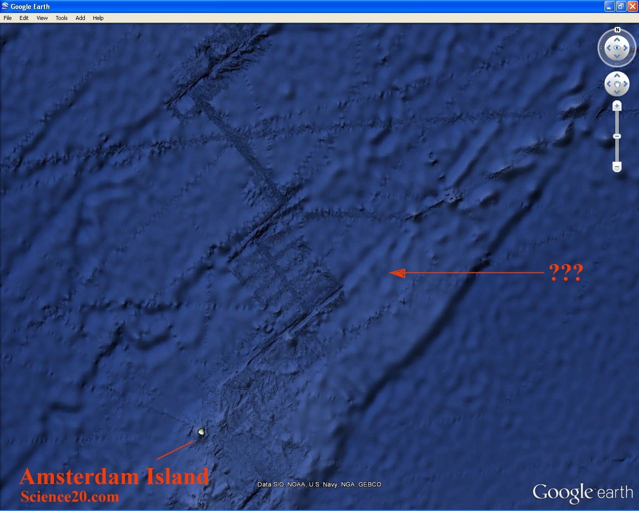
What is it that you can see in this snapshot of Google Earth in the vicinity of Amsterdam Island?
If you think it's a special antenna for transmitting earthquake waves in the general direction of people that a Secret Government AgencyTM hates, or if you just know that it's a secret underwater base you are probably a conspiracy theorist.
If you think it's Atlantis you are probably some kind of new age hippie.
If you think it's an image artifact you are probably very good at image analysis. But wrong.
It is probably no coincidence that this odd image is seen on the ocean floor near to Amsterdam Island. That remote outpost of scientific research and discovery has been in the news recently.
The French outpost lies at the edge of a stretch of ocean where the winds and waves circle endlessly eastward around Antarctica, unhindered by land masses. The region is desolate in some ways, beautiful in others, and normally escapes notice by anyone except scientists, sailors and the occasional adventurer.
The search for any debris from Malaysia Airlines MH370 is widespread. Scientists working at the Martin-de-Viviès research station on New Amsterdam have taken to walking the beaches in search of debris.
All of which has nothing to do with the mystery "object". I put that in quotes because it isn't an object as such. But it is a very real "thing".
Some of the scientists at that remote outpost have more than a passing interest in geophysics. Now, geophysics overlaps with oceanography when the particular bit of geo that you want to do physics with is under a lot of water. That is when you need a ship and some very specialized equipment.
A ship towing for example a magnetometer or sonar equipment traverses a given area in several sweeps. If the sweeps overlap you get a very good picture of the whole area. If the sweeps don't overlap you get a grid pattern of known features with little or no data in between. That is what you see in the Google Earth image - partial data presented in the form of an image.
The eye-brain interface is very good at making stuff up, so you see the strips of images as an "object". If I wasn't a trained observer my idioscenic conjecture might be that the object was a giant electric heating element pumping heat into the ocean to make the data fit the global warming theory. Or perhaps not.
In passing I should mention that the area where the underwater search for MH370 is being conducted is much better surveyed than the areas around Amsterdam Island. In particular, the Wallaby Plateau has been very extensively surveyed. This recent data may be of some help to the MH370 search teams.


Comments