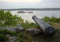
The Queen Charlotte Islands form part of Wrangellia, an exotic tectonostratiphic terrane, that includes parts of western British Columbia, Vancouver Island and Alaska. I'll be bringing my rock hammer and kayak to the mist-shrouded archipelago of Haida Gwaii next month to collect ammonites from the Middle Albian, Haida Formation. Over the years, my field work has yielded exquisitely preserved species marine specimens from the Middle Albian, including Desmoceras, Brewerikceras and Douvelliceras. This trip will be a return to some familiar sites, both because of the fossils found there and their sheer beauty, and forays to new outcrops seldom visited.
The islands are separated from the British Columbia mainland by Hecate Strait, a 40-mile wide channel of tempestuous water. Haida oral tradition tells of a time when the strait was mostly dry, dotted here and there with lakes. And indeed, during the last ice age, glaciers locked up so much water that the sea level was hundreds of feet lower than it is today. Soil samples from the sea floor of Hecate Strait contain wood, pollen, and other terrestrial plant materials that tell of a tundra-like environment. Whether or not the strait was ever completely dry during these times, it seems that it did at least contain a series of stepping-stone islands and bridges that remained free of ice.
Today, the highest peaks are often bare of vegetation and snow-covered during most of the year, but back in the time of the glaciers, these same local mountains were the birthplace of advancing ice. Precipitation and a significant drop in temperature gave rise to the Queen Charlottes ice-sheet, a thick mass of flowing ice that ran tandem with the Cordilleran sheet in the Hecate Lowlands.
Looking around today, you can see where the ice left its mark. Many of the Islands’ valleys sport the tell-tale post-glaciation U-shape profile and picturesque erratic boulders can been seen sitting like sentinels on the beach, lone watchmen with an eye to the sea. While the glaciers on the Queen Charlottes were localized, to the east, what had once been and would again be the continental coast was pressed down beneath over a kilometer of ice — the Cordilleran ice sheet.
The glaciers melted between 15,000 and 10,000 years ago, helping the Siberian big-game hunters migrate inland on foot across the Bering Land Bridge. These two events had significant effects on the level of sea and land. The first was the release of all the previously locked up water, causing a dramatic rise in sea levels. The second was the simultaneous rise of the continental edge and fall of the Charlottes. This rise in sea levels transformed the westernmost highlands and mountains of ancient BC into the archipelago of Haida Gwaii and its inhabitants into the master seafarers of the West Coast.
The Hecate Strait served the Haida much as the English Channel served the British after the Norman Conquest: it was a formidable moat that discouraged attacks from the mother continent, but which they could cross at will to explore, trade, and pillage. For many cultures, obtaining the stable food supply and permanent residences needed to develop advanced artisanship and specialized trades and crafts required becoming an agrarian society: clearing fields, planting crops, and/or raising livestock. But for the Haida, Mother Nature served as farmer, tending the tideland fields.
The enormous difference between high and low tide in Haida Gwaii – up to twenty three vertical feet – means that twice a day, vast swathes of shellfish are unveiled, free for the taking. An ancient Haida saying is still often heard today, “When the tide is out, the table is set.” Archaeological evidence shows that by about five thousand years ago, gathering shellfish replaced hunting and fishing as their primary food source.
While my trip will be focussed on big water kayaking and collecting marine molluscs for science, my stomach also hopes to enjoy some of the seafood bounty Mother Nature provides.


Comments