


They studied more than 150 miles of island coastline (essentially every beach) and found the average rate of coastal change – taking into account beaches that are both eroding and accreting – was 0.4 feet of erosion per year from the early 1900s to 2000s. Of those beaches eroding, the most extreme case was nearly 6 feet per year near Kualoa Point, East O'ahu.
Of the three islands, Maui beaches experienced the highest rates and greatest extent of beach erosion with 85% of beaches eroding. Erosion is the dominant trend of coastal change on all three islands with 71% of beaches eroding on Kaua'i and 60% of beaches eroding on O'ahu.
The researchers found that, although Hawai'i beaches are dominated by erosion as a whole, coastal change is highly variable along the shore – with 'cells' of erosion and accretion typically separated by 100s of feet on continuous beaches or by rocky headlands that divide the coast into many small embayments. Most Hawaii beaches are composed of a mix of sediment derived from adjacent reefs and from the volcanic rock of the islands. Sediment availability and transport are important factors in shoreline change, and human interference in natural processes appears to have impacted the measured rates of change. For example, more than 13 miles of beaches in the study were completely lost to erosion – nearly all previously in front of seawalls.
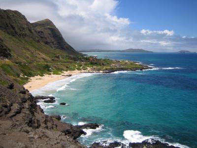
Shoreline along Makapuu Point, Oahu, Hawaii. Credit: Brad Romine, University of Hawaii Sea Grant/ Hawaii Department of Land and Natural Resources
"Over a century of building along the Hawaiian shoreline, without this sort of detailed knowledge about shoreline change, has led to some development that is located too close to the ocean," said Dr. Charles Fletcher, UH Geology and Geophysics Professor and lead author. "A better understanding of historical shoreline change and human responses to erosion may improve our ability to avoid erosion hazards in the future."
The researchers used historical data sources such as maps and aerial photographs to measure shoreline change at more than 12,000 locations. Shoreline changes are measured in specialized Geographic Information System (GIS) software. This analysis of past and present trends of shoreline movement is designed to allow for future repeatable analyses of shoreline movement, coastal erosion, and land loss.
"These data have allowed State and County agencies in Hawai'i to account for shoreline change as early as possible in the planning and development process so that coastal communities and public infrastructure can be sited safely away from erosion hazards areas," said William J. Aila Jr., Chairperson, Department of Land and Natural Resources, State of Hawai'i. "This will vastly improve upon public safety and will ensure that Hawaii's beautiful beaches will be protected from inappropriate shoreline development."


Comments