

Prior to the golden age of global exploration, during which America was first settled, little was know about the Arctic regions or even about climate science in general. Some time between 1578 and 1584, George Best described the planet's climate zones and described how the accumulated heat input to the Arctic exceeds that of the tropics during Arctic summer. He also described how the heat from the Sun is 'reflected'* by the ground and the atmosphere. In his journals recording the three Frobisher expeditions he mentions the local, seasonal and annual variability of the ice. During the three expeditions the ships were not able to penetrate very far north of Frobisher Bay. That bay, named for Sir Martin Frobisher, leader of the three expeditions of which George Best wrote, was discovered in 1576, during the first expedition.
[*] The Sun's heat is, when absorbed, re-radiated at a different wavelength, but Best appears to have been the first person to describe anything like the process now known.)
Exploring the Western Arctic
In 1585, John Davis became the first European to enter what is now called Baffin Bay. During 1616, William Baffin explored the area extensively and the Bay was later named in his honor. However, until 1818, when John Ross rediscovered the bay, its existence was widely doubted. The reason for that doubt is easy to understand: from 1616 to 1818 every attempt to explore far enough north to confirm the existence of the bay was defeated by a vast expanse of coast-to-coast ice.

In this chart, adapted from a Wikimedia Commons image, the dark blue area represents an area which was virtually impenetrable to explorers from 1617 through 1817.
Ever since the rediscovery of Baffin Bay in 1818 there has been a clear trend observable in the long term. Although in some years the ice 'recovered' enough to be a great hindrance to exploration, the ice in Baffin Bay became slowly and inexorably less and less of a hindrance to navigation. Almost year on year a new 'furthest north' discovery of a bay, fjord or glacier was recorded. By the middle of the 19th century most of the coasts around Baffin Bay had been charted, also much of the Canadian Archipelago. The lost Franklin Expedition was last seen August 1845 in the northern part of Baffin Bay waiting for the ice conditions to improve so as to permit entry into Lancaster Sound, from where further explorations were planned.
During the searches for the lost Franklin Expedition, explorers were able to penetrate ever further into the Canadian Archipelago from the south in Baffin Bay and from the north and west via Alaska. At no time was there ever continuous open water through the North West Passages. Within the archipelago ice conditions were so bad that quite a few of the searching ships had to be abandoned.
Records from sealing, whaling, fishing and exploration voyages, and from Arctic and sub-Arctic communities, show that ice conditions were quite variable around the Arctic. Despite that variability, the historical records demonstrate that every attempt to complete a voyage between the Atlantic and the Pacific by any route ended in failure until the Vega Expedition of 1878 to 1879, below. Indeed, the records show a great loss of ships and men over the centuries of Arctic exploration. The most notable disasters were the Franklin Expedition and the Jeanette Expedition, but there were many other less widely known losses.
Exploring the Eastern Arctic
While some explorers were attempting to find a North West Passage, others were seeking a route by way of Scandinavia and Russia. Although the route was explored piecemeal and proven to exist, for a very long time it was assumed to be impassable. Even those stretches of the route which were considered navigable were subject to much variability. For example, from 1648 until about 1879 the route from Kolyma to the Bering Strait, which was previously navigable for at least part of the year, was rendered completely impassable by heavy ice. It is interesting to note that this is period of over 200 years is offset by about 30 years from the 200 year period during which Baffin Bay was choked, indicating that the increase of ice in Baffin Bay was not from a purely local cause.
The first ship to complete a journey through the Arctic from the Atlantic side to the Pacific was the Vega. Adolf Erik Nordenskiöld's Vega Expedition departed Sweden in June 1878. The ship was beset in ice from September 1878 until July 1879 only two days sailing from Bering Strait. On sailing through the strait once free of the ice she completed her journey.
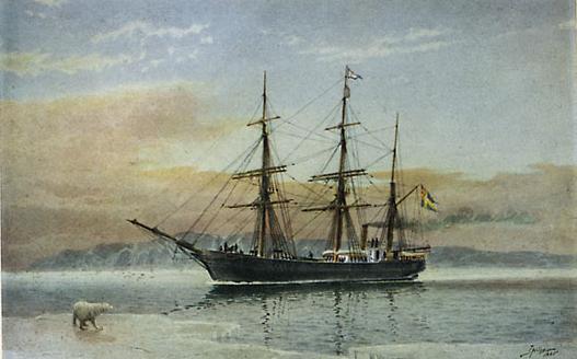
S.S. Vega
For military or commercial purposes, a route is completely useless if ships may be beset in ice for long periods. There were sound commercial reasons, as well as military ones, for wanting a more permanent Northern Sea Route for Russian shipping. Since Mother Nature declined to provide an open route, human ingenuity would fill the need. And so began the era of Arctic icebreakers.
The Yermak was launched in 1898. She was by no means the world's first icebreaker, but she was the world's first ice breaker to be built specifically for duty in the Arctic seas. The Yermak employed the technique, invented by an American, of using a bow propeller to force water under the ice in order to disperse it. The ship had trim tanks which could be used to rock the ship fore and aft or side to side in order to grind and break the ice: she could shake loose from the grip of ice if need be. The bow was shaped to ride up over the ice, and the bows could be heated by hot water from the boiler's steam condenser to keep ice from sticking to the plating.

The icebreaker Yermak, digitally processed image from a 1904 postcard
Vice Admiral Stepan Makaroff, eminent oceanographer and an early proponent of the international exchange of oceanographic data, was responsible for getting the Yermak built. His proposal to use icebreakers to precede merchant ships through the North East passage, or Northern Sea Route, was accepted in high government circles. The Yermak was the prototype which, if successful, would lead to more icebreakers being built. It was, as history shows, very successful indeed. The ship coped with the ice conditions in the way described by Makaroff in news reports and in scientific papers such as the one read to the Royal Society of Edinburgh, of which a small extract is quoted below.
The Arctic Sea in summer is certainly full of ice, but this ice is in the shape of islands, divided by the canals which are mostly filled with broken ice. The islands are of different sizes, some being as much as five miles in diameter ; the others are smaller, and the great majority of them do not exceed hundreds of feet. Sometimes these islands are pressed against each other, and there may be days during which it is difficult to proceed, but with a change of weather and current the ice islands may become separated from each other so as to render a passage possible. I do not think that going with the ice-breaker into the Polar Region it would be necessary to keep a straight course and cut the ice ; I believe that the ship should go in a " zig-zag " line, shaping her course between ice-floes. In some cases it will be necessary to apply the full power, but in other places the ship will proceed easily.The undeniable success of the Yermak led to the building of other icebreakers and the opening of the Northern Route to commercial shipping. In the first half of the 20th century, icebreakers shepherded many hundreds of ships through the Arctic. They also took part in many rescues, notably in the heavy ice years of the 1930s. Most famously, icebreakers rescued the scientists who had manned the world's first weather station on an ice floe: North Pole 1.
I spoke on this subject with Captain Sverdrup of the " Fram " and Dr Nansen. Captain Sverdrup is entirely of my opinion, but Dr Nansen did not wish to express his views ; he only said that he wished me success, and he would be the first to congratulate me upon it.
The near future will show whether my proposition and calculations are sound or not.
Vice-Admiral S. Makaroff, Imperial Russian Navy,
On some Oceanographic Problems, Proceedings of the Royal Society of Edinburgh Vol. XXII
(Read February 9, 1899.)
Even while the ice in the Eastern areas was compact enough to make the use of icebreakers essential, the variability in the Western areas permitted ships to penetrate ever further into unexplored regions. The technique used was to make use of a gap in the ice and then wait, perhaps until the next year, for a new gap to allow further progress. It was by this means that the Gjoa became the first ship ever to travel from the Atlantic to the Pacific by way of the North West Passage. The ship took the three years 1903 to 1906 along the the Southerly route to complete the passage. Until the St. Roche's famous voyages starting in 1940, no other ship completed that passage.
In the early years of the 20th century, even during the times of the worst ice conditions reported in the Siberian and Alaskan Arctic regions, the East coast of Greenland was explored further north than ever before due to the occasional opening of the pack south of Fram Strait. It should be noted that in the Arctic, the terms 'opening of the pack' and 'open water' cover a vast range of meanings. For example, when the scientists from North Pole 1 were rescued off Greenland in 1938 the icebreakers encountered much 'open water' along their journeys, but for some time after finding the scientists they could not get nearer than about a mile from the disintegrating ice floe.
Current Arctic conditions
From the reopening of access to Baffin Bay in 1818 and the reopening of the sea route from Kolyma to Bering Strait around 1879, there has been a clear and almost continual change in the behaviour of Arctic ice. The rate of that change has accelerated and appears to be accelerating more. Currently, September 2011, ice extent, volume and area are being reported by various observers as being equal to or below the previous 2007 record. (Final figures are yet to be published at the time of writing.) Baffin Bay, which for 200 years after its first discovery was choked with ice from shore to shore and completely inaccessible, is now virtually ice free by the end of every summer.
The way in which the Sun warms the Earth; the way in which the atmosphere modifies extremes of temperature; the ways in which land, sea, mountains etc. modify climates; the circulation of air and sea: all these are demonstrations of the laws of physics. Application of the laws of physics to the global environment causes the Arctic, in a warming world, to warm first and fastest. The Arctic has indisputably warmed, as proven by many thousands of historical records; as proven by satellite observations and images; as proven by current eye-witness reports.
Some very prominent public figures, journalists and bloggers are still claiming that the Arctic isn't warming, that global warming stopped in some year or other, or that global warming is a hoax. Hoax? If global warming is a hoax then it is the cleverest hoax in the whole of human history. Cleverest because the climate science data which proves global warming was being accumulated even before the U.S.A. existed!
If global warming is a hoax then the historical records of Arctic warming must all have been faked by a global conspiracy involving just about every scientist and sailor from just about every country in the world. It must also be the case that if any old person in any country claims to have witnessed climate change over their lifetime then they must be a liar and a part of the conspiracy. In fact, the total amount of evidence of global warming and its effects is so great that, if it is bogus, then more than 50% of the world's most educated people must be conspiring to fool everybody else.
Discussion
The Arctic is sending us a very clear signal that the global climate system is changing.
Insurance companies in most countries are heeding that signal.
The military organisations in many countries are heeding that signal.
The people responsible for coastal protection are heeding that signal.
Why do some people not want you to heed the signal?
Are you not curious about their motives?


Comments