

Five thousand years later, we know about the ancient settlement because of a cataclismic event: a powerful earthquake, probably around the year 1000 BC (or maybe a series of earthquakes along a much longer time frame) caused the sinking of the ground around the old town, bringing the town floor three meters below sea level, and changing forever the topography of the area. What was probably a peninsula south of Pavlopetri became the small island of Elafonisos, and a shallow 400 meter wide channel opened up in between.
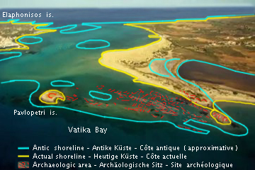 Because of the sinking, what remained of the town was not entirely destroyed: instead of being built over, all stones scavenged and reused, or buried underground, the town floor remained almost untouched, forgotten, and only slowly eroded by five thousand years of natural events. Nobody knew there was an old town down there, just a few meters off the shoreline, almost literally at a dive's distance from the wonderfully scenic beach of Punta, a sandy strip backed by a lagoon and overlooking an amazing sea of crystal clear azure waters. (Above, left: aerial view of the site of Pavlopetri, with a reconstruction of the antique shoreline. Source: Wikipedia. Below: another aerial view of the site; Pavlopetri is on the top right. Image credit: purpleblog).
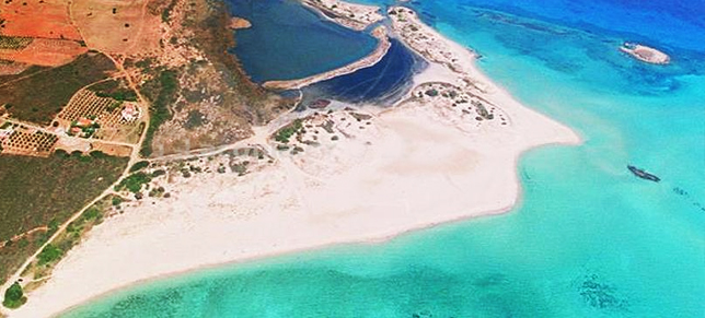
The ruins were discovered in 1967 by oceanographer Nicholas Flemming, and were mapped soon thereafter by british archaeologists. The picture that emerges from their work is that of a quite remarkable ancient town, covering an area of 300 by 150 meters, with over 15 buildings, roads, courtyards, and chamber tombs. Several archaeological findings dated the town at 2800 BC after an initial erroneous assessment putting it in the mycenean period (1700-1200BC).
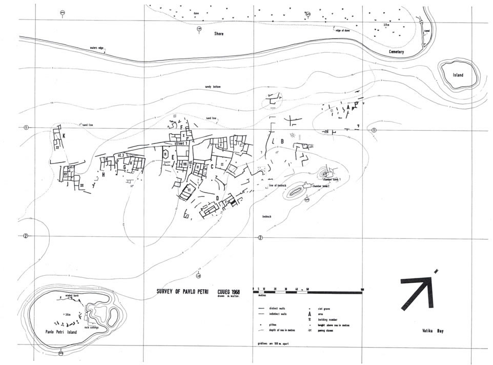
(Above: a detailed map of the ruins as reconstructed by Nottingham University).
As I happen to be spending my summer vacations in the beautiful island of Elafonisos, I could not miss the chance to explore the site, which is quite easy to visit due to its vicinity to the beach and the shallowness of the waters above it. So yesterday I had a long swim above the ruins, and could enjoy the feeling of swimming in the oldest submerged city in the world. Quite a remarkable experience!
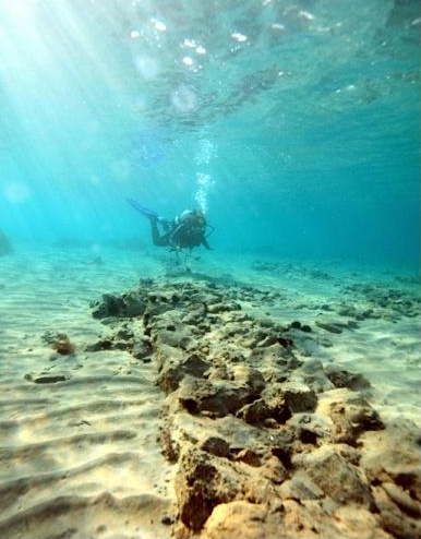 The area ashore is totally desert, so by sitting on the beach in front of the ruins one has little trouble imagining how the place was five thousand years ago: no channel on the right, the shoreline 200 meters further east, and buildings, roads, and a flourishing port can easily find their place in front of you, with a little fantasy. (Left: ruins of the wall of a house. Image credit: BBC/John Enderson).
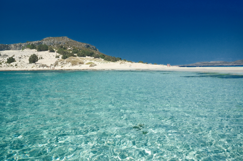
(Above: the crystal clear waters of Mikri Simos, one of the beautiful beaches of the Elafonisos island. Image credit: www.elafonisos.biz).
If you travel around Peloponnese there are many archaeological marvels worth the time you'll spend reaching them. Archaea Olympia, Nestor's Temple, Mycenes are only three of them you should definitely not miss. But if you like to dive in azure waters, please consider a visit to Pavlopetri. Please don't touch anything though: the site is endangered by boats' anchors and by scavengers, although as far as I can see there is not too much activity in the area even during the summer - except me, only a couple of other scuba divers and a boat of tourists who could see the floor plan through the water, sitting on the deck.


Comments