


It sounds like it should be easy enough to know if ice is growing or retreating, but it really isn't. Antarctic sea ice has been expanding, we are told, while Arctic sea ice is retreating, both at dramatic rates.
How accurate is satellite data? Processing errors can be a problem, but they are more heavily scrutinized whenever a study finds that sea ice anywhere is increasing. A paper in The Cryosphere tackles the satellite data problem, for the increase measured in Southern Hemisphere sea ice.
In contrast to Arctic sea ice, the Antarctic
sea ice extent
is expanding and has reached record highs in recent years - a puzzle for climate scientists in a warming world. The authors of a new paper say it is due to error, but unfortunately errors work in lots of ways. They call into doubt both the 2007 and 2013 IPCC reports by seeking to debunk just one finding.
"Antarctic sea ice trends reported in the IPCC's AR4 and AR5 [the 2007 and 2013 assessment reports from the Intergovernmental Panel on Climate Change] can't both be correct: our findings show that the data used in one of the reports contains a significant error. But we have not yet been able to identify which one contains the error," says lead-author Ian Eisenman of the Scripps Institution of Oceanography at University of California San Diego.

To measure sea ice cover, researchers splice together observations from different instruments flown on a number of different satellites. They then use an algorithm -- the most prevalent being the Bootstrap algorithm – and further processing to estimate sea ice cover from these data. A new The Cryosphere study compares two datasets for sea ice measurements: one generated using a version of Bootstrap updated in 2007, and another that results from an older version of the algorithm. Subtracting the older dataset from the new one, shows a spurious jump in the satellite record in December 1991. The vertical dotted lines indicate transitions between satellite sensors, with the December 1991 change dominating the difference in ice cover in the two versions. Credit: Eisenman et al., The Cryosphere, 2014
Reflecting the scientific literature at the time, the AR4 reported that Antarctic sea ice cover remained more or less constant between 1979 and 2005. On the other hand, recent literature and the AR5 indicate that, between 1979 and 2012, Southern Hemisphere sea ice extent increased at a rate of about 16.5 thousand square kilometers per year. Scientists assumed the difference to be a result of adding several more years to the observational record.
"But when we looked at how the numbers reported for the trend had changed, and we looked at the time series of Antarctic sea ice extent, it didn't look right," says Eisenman, who set out to figure out what was wrong.
Scientists have used satellite data to measure sea ice cover for 35 years. But the data doesn't come from a single instrument, orbiting on a single satellite throughout this period. Instead, researchers splice together observations from different instruments flown on a number of different satellites. They then use an algorithm – the most prevalent being the Bootstrap algorithm – and further processing to estimate sea ice cover from these data.
In the study published in The Cryosphere, Eisenman and collaborators compare two datasets for sea ice measurements. The most recent one, the source of AR5 conclusions, was generated using a version of Bootstrap updated in 2007, while the other, used in AR4 research, is the result of an older version of the algorithm.
The researchers found a difference between the two datasets related to a transition in satellite sensors in December 1991, and the way the data collected by the two instruments was calibrated. "It appears that one of the records did this calibration incorrectly, introducing a step-like change in December 1991 that was big enough to have a large influence on the long-term trend," explains Eisenman.
"You'd think it would be easy to see which record has this spurious jump in December 1991, but there's so much natural variability in the record – so much 'noise' from one month to the next – that it's not readily apparent which record contains the jump. When we subtract one record from the other, though, we remove most of this noise, and the step-like change in December 1991 becomes very clear."
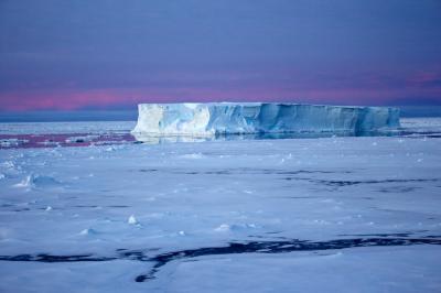
A tabular iceberg surrounded by sea ice in the Antarctic.
Credit: Eva Nowatzki, distributed via imaggeo.egu.eu
With the exception of the longer time period covered by the most recent dataset, the two records were thought to be nearly identical. But, by comparing the datasets and calculating Antarctic sea ice extent for each of them, the team found that there was a stark difference between the two records, with the current one giving larger rates of sea ice expansion than the old one in any given period.
If the error is in the current dataset, the results could contribute to an unexpected resolution for the Antarctic sea ice cover enigma.


Comments