

For thousands of years the Arctic has been covered in perennial ice with seasonal changes at the margins and some natural variation, seen as losses and recoveries of extent.
For hundreds of years observers have noted that seasonal and local variations at the margins can leave some relatively small regions ice free one year, and solidly iced up in other years.
Since about the middle of the 19th century, explorers were able to slowly expand our knowledge of areas which had previously been entirely inaccessible due to the continued presence of old, thick ice. With a hindsight gained from studies of historic records we can see that the effect of ice as an obstacle to exploration had been slowly decreasing since about 1850. This was not due to great advances in ship design. Rather, the ability of explorers to beat 'furthest north' records one after another can be attributed mainly to a retreat of the perennial ice and its seasonal ice margin.
During the 20th century the ice gradually became even less of an obstacle.
Until Gjoa, 1903 - 1906, no ship had ever traversed the North West Passage.
Until St. Roche, 1940 - 1942, only one ship - Gjoa - had traversed the NWP.
In 1944 St. Roche became the first ship to traverse the NWP in a single season.
In 2007 the NWP melted out through its entire length for the first time.
In 2010 most of the alternate North West Passage routes melted out, together with most of the passages through the Canadian Archipelago.
Arctic ice is reducing at an accelerating rate, and the rate of acceleration has clearly increased in the 21st century.
This graph of anomalies since 1979 from Cryosphere Today shows a clear downward trend in sea ice extent. Note especially the trends from 1997 and from 2005.

Cryosphere Today 'tale of the tape' - April 02 2011
Resized at 10% - from the original image:
http://arctic.atmos.uiuc.edu/cryosphere/IMAGES/sea.ice.anomaly.timeseries.jpg
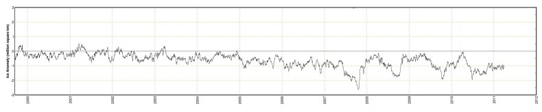
The years 2000 - 2011 from 'tale of the tape'.
------------------------------------------------------------
An Arctic decade of images, notes and reports
I present here some satellite images of the area around Greenland from 2001 to 2011, together with various scientific reports, news items and notes.
The focus in my Arctic-themed articles is generally on the area which includes Greenland, Ellesmere Island and the Canadian Archipelago. The reason is that old ice from the main pack tends to be pressed along those northern shores and exported through the many channels. What happens in those regions is - I suggest - likely to have a greater impact on ice volume decline than most other regions. Export of multi-year ice in that region - other than through Fram Strait - has historically been quite slow.
The flow of ice from Fram Strait follows the Greenland current down past Cape Farewell (Kap Farvel) and up the west coast. Until the 20th century the summer heat would melt only about half of the ice in Baffin Bay, all or part of the west coast from Cape Farewell to Disko (Qeqertarsuaq) and only a small part of the east coast ice. Scoresbysund would also be briefly accessible in the late summer of most years.
The chart below shows coastal ice extent near Fram Strait in 1993.
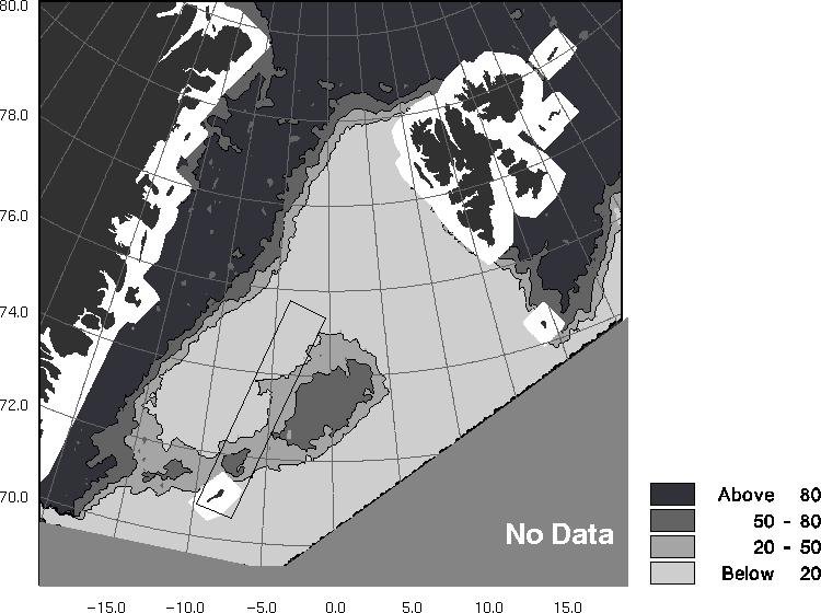
Odden Ice Tongue February 16, 1993
Image source: http://earth.esa.int/...
As I wrote in Arctic Tipping Points - #7 - the Odden Ice Tongue used to form between Greenland and the island of Jan_Mayen. It has not been seen since 1997. That ice tongue - together with the vast sheets of shorefast ice along Greenland's east coast - tended to obstruct the export of Arctic ice through Fram Strait. That shorefast ice now melts away almost entirely in summer. At the end of last summer only a remnant remained. Now, as the Arctic melt season gets fully under way there is less of that shorefast ice remaining than in August 2010.
Charts and graphs of ice extent tend to mask the difference between ice merely flowing along a coast as separate floes, and consolidated ice firmly attached to the shore. The difference - I suggest - is a critical 'materials science' element in the dynamics of Arctic ice gain and loss. It is a difference which can be seen, not so much by looking at charts, but more by looking at satellite images.
The following images are from the NASA MODIS archives. Some have been cropped and / or rotated. The images have been selected to be free enough of cloud so as to show areas of significance. Readers are invited to check these against other images in the archives - at the link given in the footnotes.
------------------------------------------------------
Arctic 2001
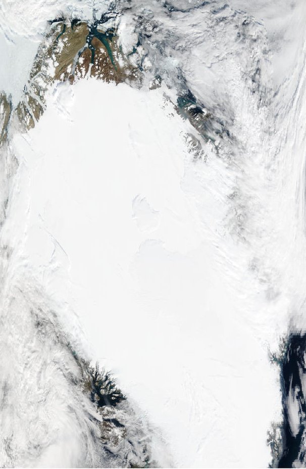
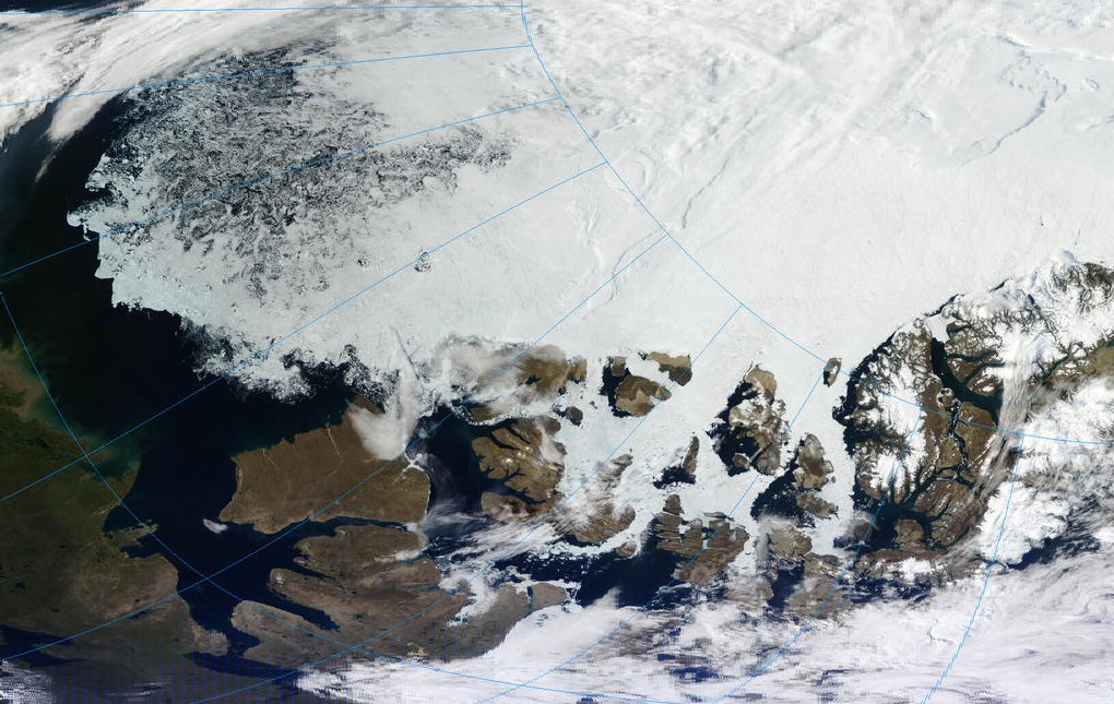
Greenland east coast June 01 2001
A band of shorefast ice can be seen. This is much narrower than it was generally before the 1990s.
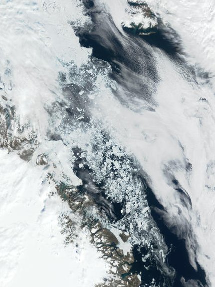
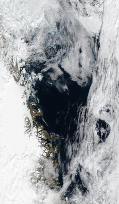
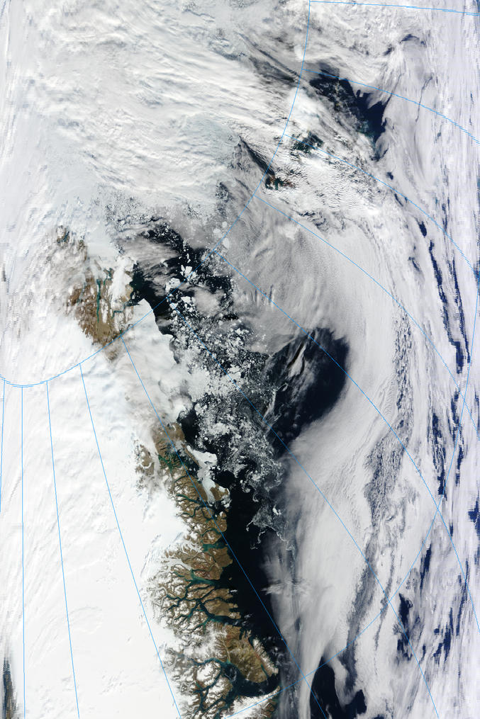
Fram Strait July 31 2001
Despite extensive open water, ice export through the strait is not substantial. This suggests that processes must be acting to hinder ice export despite open water intrusion.
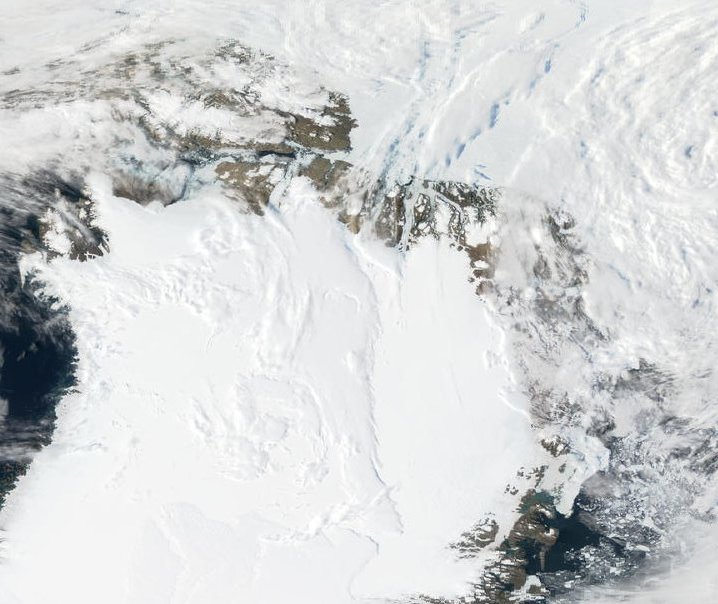
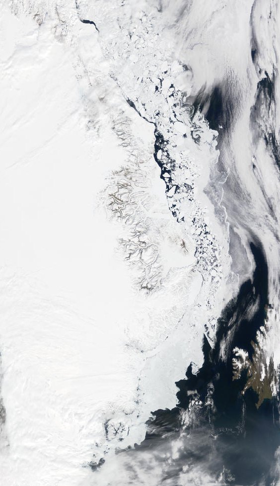
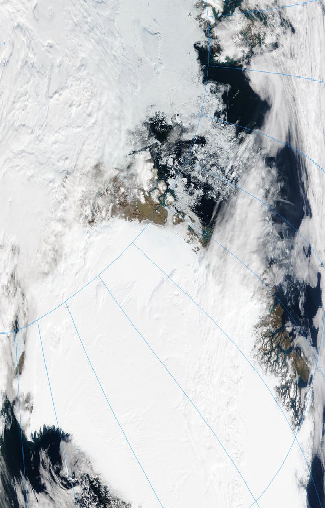
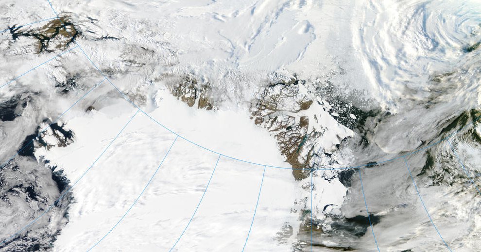
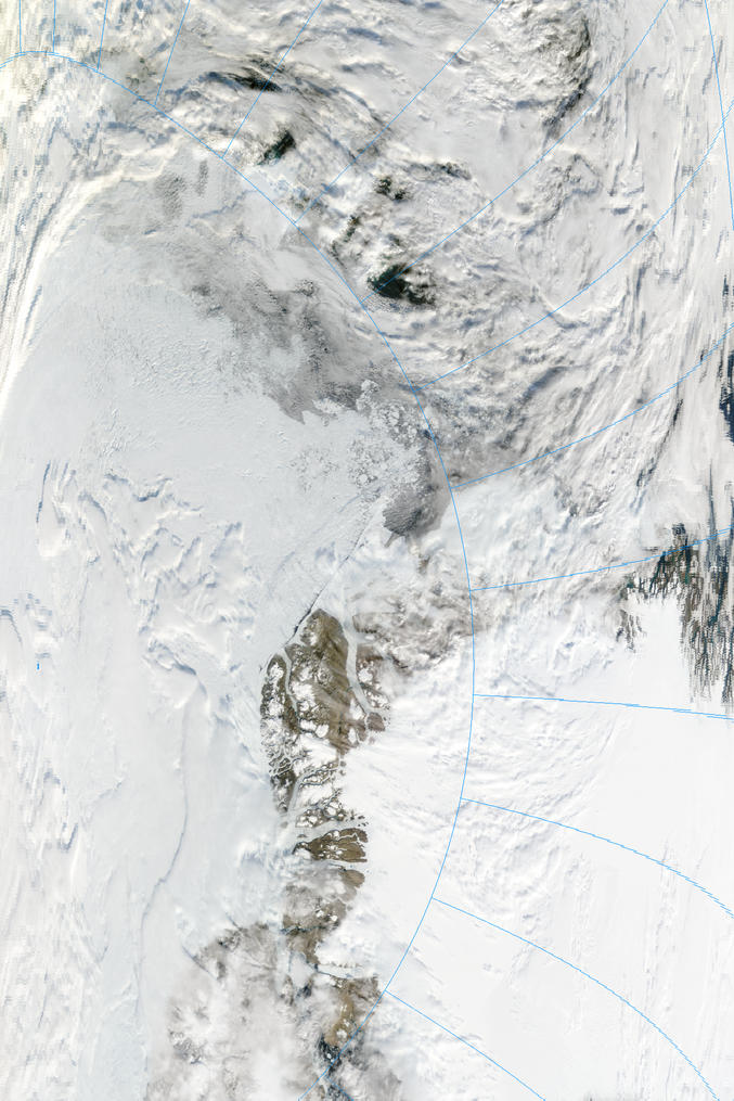
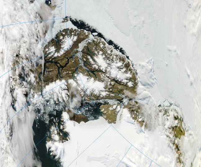
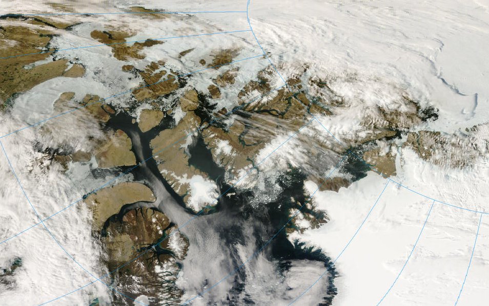
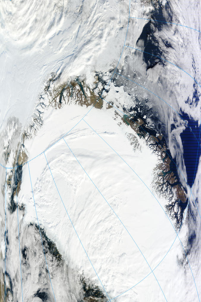
North Greenland August 15 2001
Baffin Bay is mostly ice free. Some shorefast ice remains south of Flade Isblink. Nares Strait contains ice exported from Lincoln Sea. The NWP and passages through the Canadian Archipelago are blocked with ice.
October 1, 2001 - (date of web publication)------------------------------------------------------
ICELANDIC WEATHER SYSTEM HELPS DECIPHER CHANGES IN THE ARCTIC ICE PUZZLE
Largely natural "ups and downs" in a weather system centered near Iceland have contributed to regional variations and an overall decrease in Arctic sea ice cover over the last twenty years, according to new NASA research.
...
... the satellite data reveal an overall decrease in Arctic sea ice extent since 1978."
The overall decrease in sea ice cover has generated questions about whether Arctic sea ice is being influenced by global warming. Parkinson urges caution in drawing conclusions for decreases in Arctic ice. "The trend of decreasing ice extent showed some signs of reversing in the 1990s," she noted. "Whether the ice cover as a whole will continue to exhibit the decreases that it experienced over the 1979 to 1999 period might depend on the strength and phase of the NAO, as well as on long-term trends in the climate system."
Source: http://www.gsfc.nasa.gov/topstory/20011001icepuzzle.html
Arctic 2002
Greenland August 11 2002
There is substantial melt on the east coast. Baffin Bay is virtually ice free.
Fram Strait August 20 2002
Ice export is not substantial.
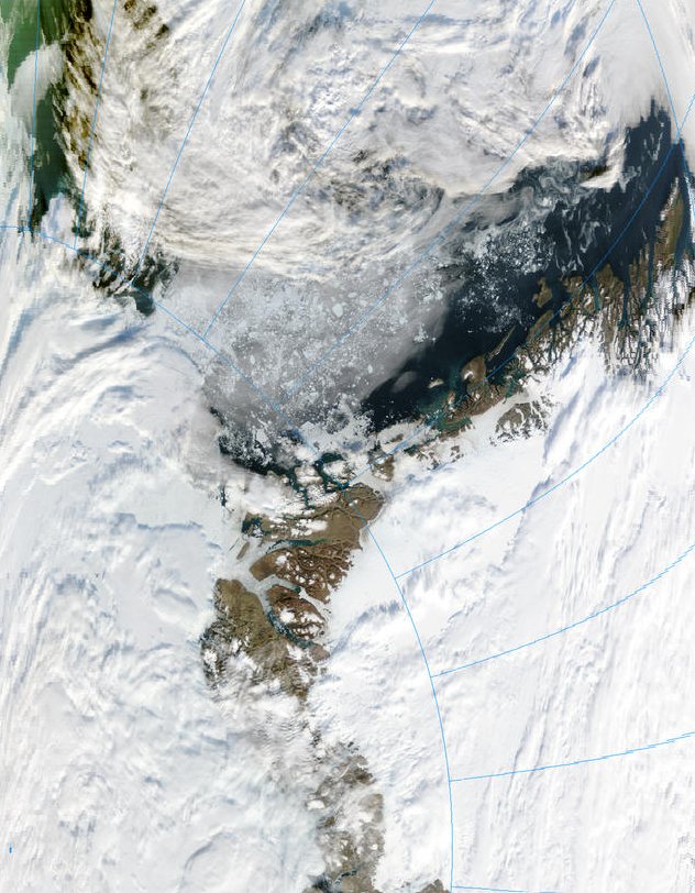
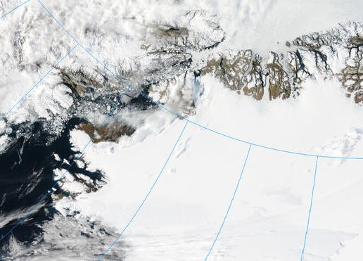
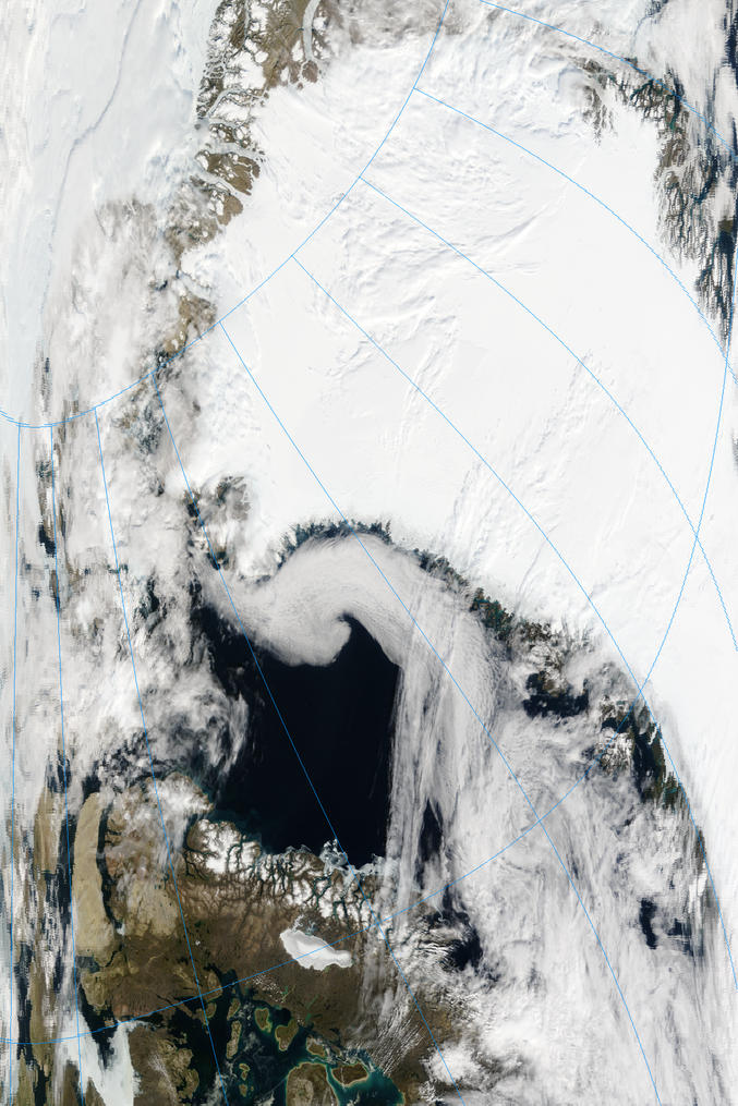
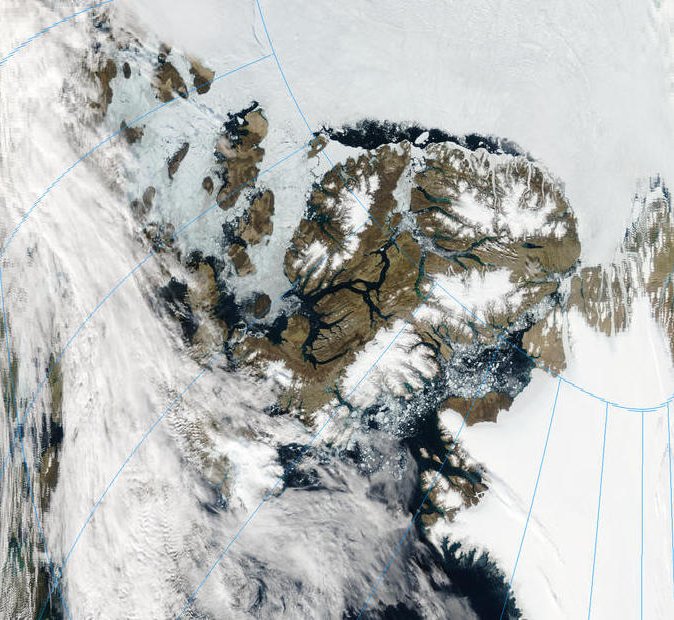
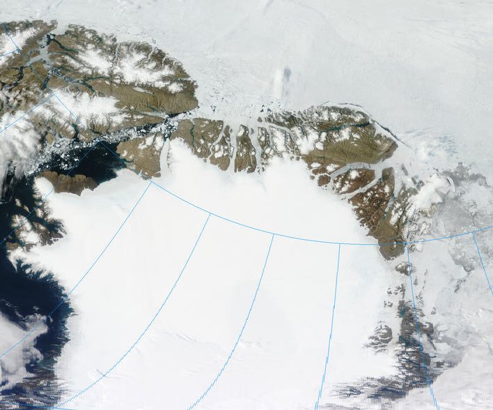
August 28 2002 North Greenland and the Canadian Archipelago
Nares Strait is choked at the Lincoln Sea end. The CA passages are chocked with ice, but the NWP shows strong signs of melting. CNN asks:
"Will ice melt open fabled Northwest Passage?"
August 29, 2002
Rapid melting of the Arctic ice pack may turn a cherished sailor's myth into reality. The Northwest Passage, the legendary shipping shortcut from the Atlantic to the Pacific, could be ice-free in as few as 10 years, many predict.
A well-documented continuing Arctic thaw is reducing polar ice, a change that is likely to have profound effects on commerce, ecology and native cultures, according to author Richard Kerr, writing in the journal Science.
more >>> CNN NWP
December 7, 2002
ARCTIC SEA ICE SHRINKING, GREENLAND ICE SHEET MELTING, ACCORDING TO STUDY
The total area of surface melt on the Greenland Ice Sheet for 2002 broke all known records for the island and the extent of Arctic sea ice reached the lowest level in the satellite record, according to scientists at the University of Colorado at Boulder.
http://nsidc.org/news/press/20021207_seaice.html
---------------------------------------------------------
Arctic 2003
Greenland August 03 2003
Baffin Bay and east coast are again virtually ice free.
Fram Strait August 05 2003
Even though ice melt extends across Fram Strait and north of Spitsbergen, ice export through Fram Strait is not substantial.
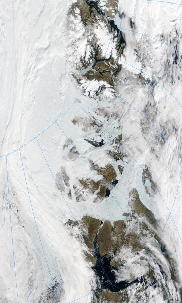
Canadian Archipelago August 05 2003
One of the routes through the NWP is becoming navigable - but only just.
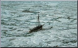
The NWP was open enough in late 2003 for the yacht Vagabond to pass through - with some difficulty. Vagabond had previously crossed Bering Strait - August 31 2002 - and had become the first yacht to sail the North-East Passage without wintering, and without the aid of an icebreaker. Between July and October 2003 she sailed the NWP, thus completing the Arctic circumnavigation.
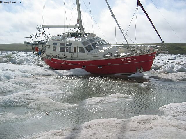
Vagabond in Arctic Ice
image copyright vagabond.fr - fair use claimed for promoting knowledge of this vessel and crew's historic achievements.
2003 marks the centenary of the start of Roald Amunden's 3 year voyage through the NWP in the vessel Gjoa.
Amundsen-Gjoa Centenary
The summer 2003 it was exactly a century ago since Norwegian polar explorer Roald Amundsen set out to navigate through the Northwest Passage in Canada. Amundsen departed Oslo in June 1903 on his ship Gjøa with the aim of sailing through the Northwest Passage, and researhing the Magnetic North Pole. Amundsen and his crew stayed over two winters in what he called "the finest little harbour in all the world", which now carries the name Gjoa Haven. Here they befriended the local Inuit population and picked up vital knowledge on how to survive in a very tough climate. They then continued their journey west on 13 August, 1905. The entire trip took 3 years ...
8 December 2003------------------------------------------
Arctic Sea Ice Low, Second Year in a Row
Last year's sea ice extent and concentration set a new record low in the Arctic. 2003 was a close second, according to remote sensing data from September, when sea ice in the northern latitudes is typically at its lowest, after the summer melt season.The near-record low in 2003, accompanied by sea ice trends showing a steady decline over the last decade, is significant to scientists researching global warming. Not only is sea ice an indicator of possible climate change, but the loss of sea ice itself may further compound the problem.
http://nsidc.org/news/press/20031208_minimum.html
Arctic 2004
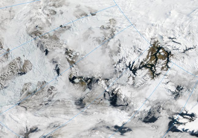
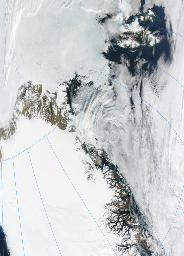
North Greenland August 31 2004
Baffin Bay is substantially ice free. On the east coast some shorefast ice lingers in Fram Strait.
Nares Strait August 30 2004
Ice is being advected into Baffin Bay, where it melts.
NWP and Canadian Archipelago August 31 2004
There has been substantial melting throughout the area.
The NWP was open very briefly. Dagmar Aaen was the only vessel to pass through the NWP in 2004 without icebreaker assistance, becoming only the third ship to transit the NWP without icebreaker assistance.
Dagmar Aaen in NWP ice.
image source: http://www.arved-fuchs.de/expeditionen/expeditionengl.html
4 October 2004
Arctic Sea Ice Decline Continues
The extent of Arctic sea ice in September — the end of the summer melt period — is the most valuable indicator of the health of the ice cover.
...
In 2002, September ice extent was 15 percent below average conditions. This represents an area roughly twice the size of Texas (or Iraq). From comparisons with records prior to the satellite era, this was probably the least amount of sea ice that had covered the Arctic over the past 50 years. Quite often, a "low" ice year is followed by recovery the next year. However, September of 2003 was also very extreme, with 12 percent less ice than average. Calculations performed on September 30, 2004 show a sea ice loss very nearly matching that of 2002, especially north of Alaska and eastern Siberia.
Why has Arctic sea ice declined so sharply over the past few years? One argument is that greenhouse warming — increases in the earth's temperature due to the burning of fossil fuels that increase the atmosphere's content of "heat trapping" carbon dioxide — is more apparent. With progressively more summer melt and less ice growth in winter, sea ice may reach a threshold beyond which it can no longer rebound. Climate models are in general agreement that one of the strongest signals of greenhouse warming will be a loss of Arctic sea ice. Some indicate complete disappearance of the summer sea ice cover by the year 2070.
http://nsidc.org/news/press/20041004_decline.html
--------------------------------------------------------------------
Arctic 2005
Summer Arctic sea ice falls far below average for fourth year, winter ice sees sharp decline, spring melt starts earlier - NSIDC September 28 2005
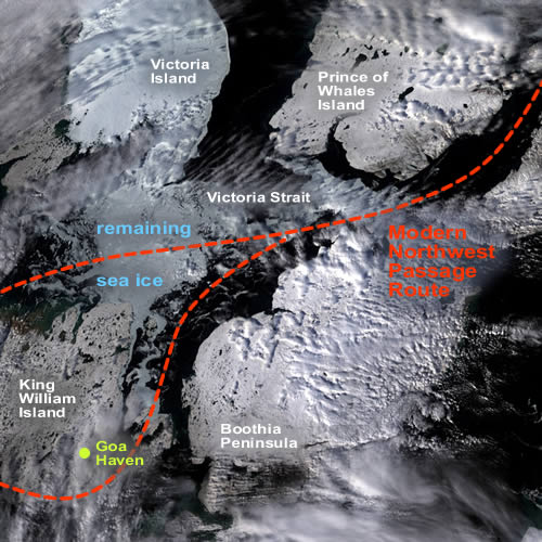
This satellite image shows ice conditions in the Northwest Passage on September 13, 2005. Only 40 miles of scattered ice obstructed Victoria Strait. In previous years, the Northwest Passage was heavily clotted with sea ice—the first expedition to successfully make the voyage was Amundsen's, in 1905. The team took more than 2 years to complete the journey through the icepack. On September 13, 2005, Amundsen's route was nearly ice-free. (Moderate-Resolution Imaging Spectroradiometer image)
http://nsidc.org/news/press/20050928_trends_fig6.html
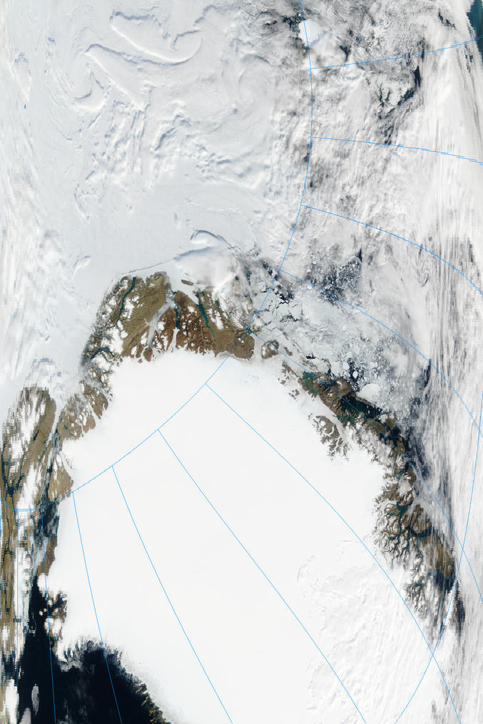
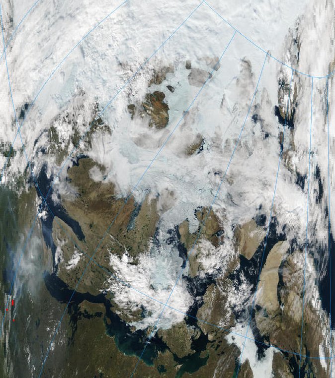
Greenland August 08 2005
Nares Strait and Baffin Bay August 08 2005
NWP and Canadian Archipelago August 08 2005
18 March 2005
Arctic Ice Decline in Summer and Winter
...
The past three years have witnessed a strong decline in summer ice extent in the Arctic, but ice concentration has rebounded in the winters of 2002-2003 and 2003-2004. The winter of 2004-2005 has been different. Besides a strong summer decline in ice concentration, the Arctic now shows a winter decline as well.
http://nsidc.org/news/press/20050318_arcdec.html
28 September 2005
Sea Ice Decline Intensifies
Summer Arctic sea ice falls far below average for fourth year, winter ice sees sharp decline, spring melt starts earlier
...
For the fourth consecutive year, NSIDC and NASA scientists using satellite data have tracked a stunning reduction in arctic sea ice at the end of the northern summer. The persistence of near-record low extents leads the group to conclude that Arctic sea ice is likely on an accelerating, long-term decline.
http://nsidc.org/news/press/20050928_trendscontinue.html
-------------------------------------------
Arctic 2006
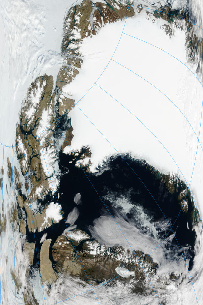
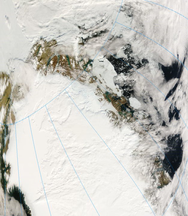
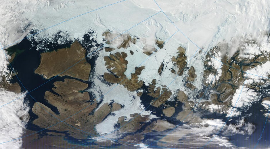
North Greenland August 08 2006
Nares Strait and Baffin Bay August 08 2006
NWP August 08 2006
5 April 2006
Winter Sea Ice Fails to Recover, Down to Record Low
Scientists at NSIDC announced that March 2006 shows the lowest Arctic winter sea ice extent since the beginning of the satellite record in 1979
http://nsidc.org/news/press/20060404_winterrecovery.html
3 October 2006
Arctic Sea Ice Shrinks as Temperatures Rise
Despite cool temperatures in August, summer sea ice falls below normal for fifth year
The year 2006 continues the pattern of sharply decreasing Arctic sea ice, raising further concern that the Arctic is responding to greenhouse warming. NSIDC Senior Research Scientist Mark Serreze said, “If fairly cool and stormy conditions hadn’t appeared in August, slowing the rate of summer ice loss, I feel certain that 2006 would have surpassed last year’s record low for September sea ice.”
http://nsidc.org/news/press/2006_seaiceminimum/20061003_pressrelease.html
---------------------------------------------------------
Arctic 2007
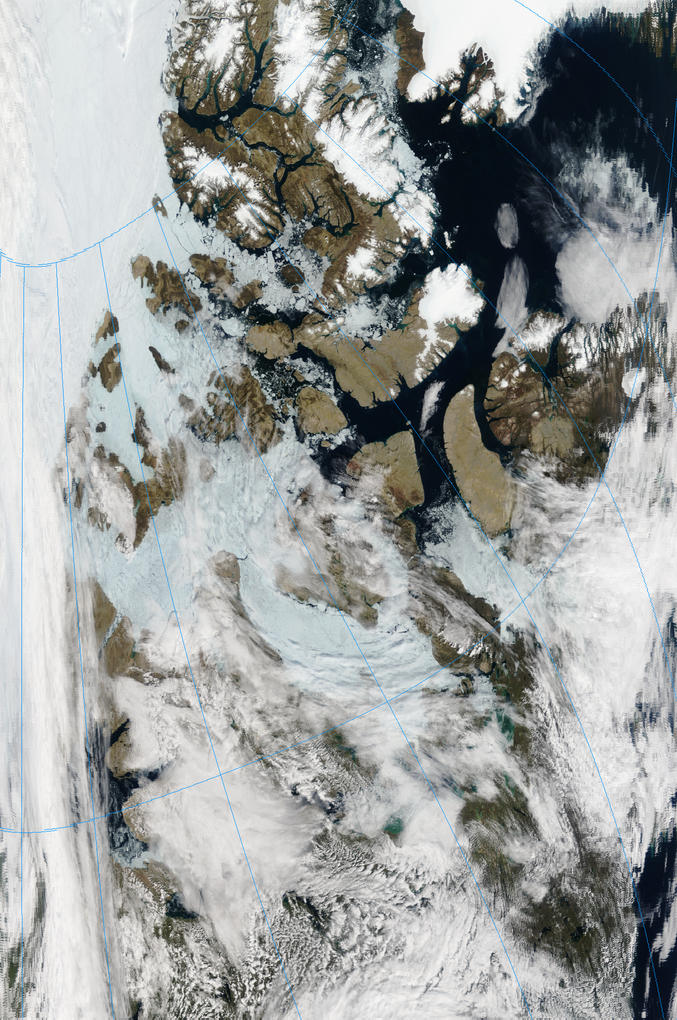
North Greenland and Fram Strait August 08 2007
Nares Strait August 09 2007
NWP August 10 2007
4 April 2007
PRESS RELEASE: Arctic Sea Ice Narrowly Misses Wintertime Record Low
NSIDC scientists announced that the winter 2007 Arctic sea ice maximum was the second-lowest in the satellite record, narrowly missing the March 2006 record
...
NSIDC scientist Walt Meier said, "This year's low wintertime extent is another milestone in a strong downward trend. We're still seeing near-record lows and higher-than-normal temperatures. We expect the downward trend to continue in future years."
http://nsidc.org/news/press/20070403_winterrecovery.html
30 April 2007
PRESS RELEASE: Models Underestimate Loss of Arctic Sea Ice
Arctic sea ice is melting at a significantly faster rate than projected by the most advanced computer models, a new study concludes ...
http://nsidc.org/news/press/20070430_StroeveGRL.html
1 October 2007-------------------------------------------
Arctic Sea Ice Shatters All Previous Record Lows
Diminished summer sea ice leads to opening of the fabled Northwest Passage
Arctic sea ice during the 2007 melt season plummeted to the lowest levels since satellite measurements began in 1979....At the end of the melt season, September 2007 sea ice was 39 percent below the long-term average from 1979 to 2000 (see Figure 2). If ship and aircraft records from before the satellite era are taken into account, sea ice may have fallen by as much as 50 percent from the 1950s.
http://nsidc.org/news/press/2007_seaiceminimum/20071001_pressrelease.html
Arctic 2008
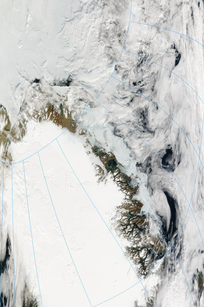
North Greenland August 06 2008
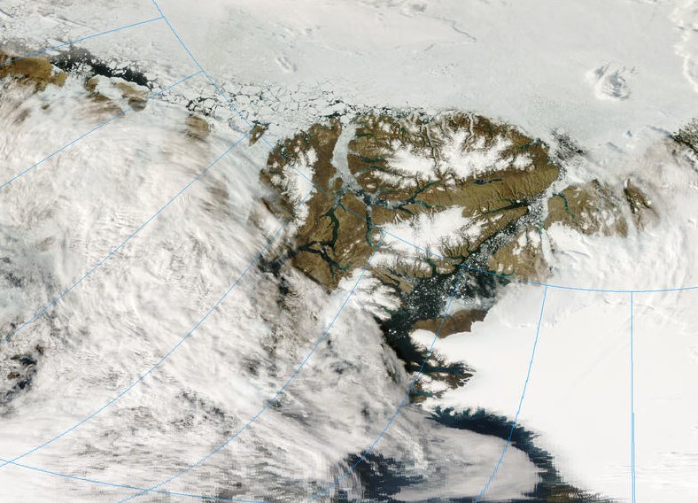
Nares Strait August 06 2008
NWP August 04 2008
April 7, 2008
Arctic sea ice extent at maximum below average, thin
Arctic sea ice reached its yearly maximum extent during the second week of March, 2008. Maximum extent was slightly greater compared to recent years, but was still well below average.
Despite strong growth of new ice over the winter, sea ice is still in a general state of decline. The ice that grew over the past winter is relatively thin, first-year ice that is susceptible to melting away during the summer. Although natural variability in the atmospheric circulation could prevent the ice pack from breaking last year's summer record, a closer look at sea ice conditions indicates that the September 2008 minimum extent will almost certainly be well below average.
http://nsidc.org/arcticseaicenews/2008/040708.html
2 October 2008----------------------------------------------------------
Arctic Sea Ice Down to Second-Lowest Extent; Likely Record-Low Volume
Despite cooler temperatures and ice-favoring conditions, long-term decline continues
...
Arctic sea ice extent during the 2008 melt season dropped to the second-lowest level since satellite measurements began in 1979,
...
The 2008 season strongly reinforces the thirty-year downward trend in Arctic ice extent. The 2008 September low was 34% below the long-term average from 1979 to 2000 and only 9% greater than the 2007 record
...
NSIDC Senior Scientist Mark Serreze said, “When you look at the sharp decline that we’ve seen over the past thirty years, a ‘recovery’ from lowest to second lowest is no recovery at all. Both within and beyond the Arctic, the implications of the decline are enormous.” http://nsidc.org/news/press/20081002_seaice_pressrelease.html
Arctic 2009
North Greenland August 09 2009
Fram Strait August 29 2009
NWP August 26 2009
March 30, 2009
Annual maximum ice extent confirmed
Arctic sea ice extent reached its maximum extent for the year, marking the beginning of the melt season. This year’s maximum was the fifth lowest in the satellite record.
...
The six lowest maximum extents since 1979 have all occurred in the last six years (2004 to 2009).
http://nsidc.org/arcticseaicenews/2009/033009.html
6 October 2009
Arctic sea ice extent remains low; 2009 sees third-lowest mark
At the end of the Arctic summer, more ice cover remained this year than during the previous record-setting low years of 2007 and 2008. However, sea ice has not recovered to previous levels. September sea ice extent was the third lowest since the start of satellite records in 1979, and the past five years have seen the five lowest ice extents in the satellite record.
NSIDC Director and Senior Scientist Mark Serreze said, “It’s nice to see a little recovery over the past couple years, but there’s no reason to think that we’re headed back to conditions seen back in the 1970s. We still expect to see ice-free summers sometime in the next few decades.”
http://nsidc.org/news/press/20091005_minimumpr.html
-----------------------------------------------------
Arctic 2010
Greenland August 31 2010
Fram Strait August 08 2010
NWP August 16 2010
April 6, 2010
Cold snap causes late-season growth spurt
Arctic sea ice reached its maximum extent for the year on March 31 at 15.25 million square kilometers (5.89 million square miles). This was the latest date for the maximum Arctic sea ice extent since the start of the satellite record in 1979.Early in March, Arctic sea ice appeared to reach a maximum extent. However, after a short decline, the ice continued to grow. By the end of March, total extent approached 1979 to 2000 average levels for this time of year. The late-season growth was driven mainly by cold weather and winds from the north over the Bering and Barents Seas. Meanwhile, temperatures over the central Arctic Ocean remained above normal and the winter ice cover remained young and thin compared to earlier years.
http://nsidc.org/arcticseaicenews/2010/040610.html
October 4, 2010------------------------------------------
Weather and feedbacks lead to third-lowest extent
An eventful summer sea ice melt season has ended in the Arctic. Ice extent reached its low for the year, the third lowest in the satellite record, on 19 September. Both the Northwest Passage and the Northern Sea Route were open for a period during September.
http://nsidc.org/arcticseaicenews/2010/100410.html
Arctic 2011
March 23, 2011
Annual maximum ice extent reached
Arctic sea ice extent appeared to reach its maximum extent for the year on March 7, marking the beginning of the melt season. This year's maximum tied for the lowest in the satellite record. NSIDC will release a detailed analysis of 2010 to 2011 winter sea ice conditions during the second week of April.
...
Final analysis pending
In the beginning of April, NSIDC will issue a formal announcement with a full analysis of the 2010 to 2011 winter season, and graphics comparing this year to the long-term record. We will also announce the monthly average March sea ice extent, the measure scientists rely on for accurate analysis and comparison over the long term. http://nsidc.org/arcticseaicenews/2011/032311.html
The sea ice has grown younger and thinner while it has been declining in extent.
At the time of posting this article, Nares Strait and NWP ice is breaking up. Ice at the northern ends of some passages through the Canadian Archipelago shows signs of imminent break-up.
The Arctic has for some time now been pre-conditioned for rapid ice loss.
How rapid will the loss be in this year, 2011?
-----------------------------------------------------------------------------
MODIS image source -
http://rapidfire.sci.gsfc.nasa.gov/
Related articles:
Arctic Ice 2011 - Sail, Steam And Satellites
Arctic Ice March 2011
Arctic Ice March 2011 - Update #1
ice-in-baffin-bay
Nares Ice Bridge Breakup
The ChatterBox Arctic Index
Further resources:
Arctic Sea Ice Blog
arctic sea ice graphs


Comments