


With just the concussive force of the meteorite explosion shattering things, you can imagine what would have happened if a meteorite hit a building - one meteorite did land, thankfully in a lake near Chebarkul rather than on a house.
But Russia generates almost 20% of its energy from nuclear power and if it hit a nuclear power plant (let's not get crazy, they have 31 plants and Russia is a big country, the largest in the world, so a meteorite ever hitting a nuclear plant is a remote possibility) that would have been a real disaster - and Russia has had a lot of nuclear disasters, they don't deserve more. I wanted to see beyond what the newspaper was giving me, with their repeated talk of the explosion and the injuries, and give it some context outside the personal - basically, I wanted to see what else was around there.
Luckily, I had just agreed to review the Atlas by Collins app so it made perfect sense.
If you don't know HarperCollins as a name, you still know their products. They make the Collins Atlas and the Times Atlas of the World, which is the definitive atlas out thereThe interactive app is only for iOS so Android users are out of luck but when you look at it, you can see why it might not make sense to be on Android anyway. When using an Atlas you want to have some real visual detail and my rooted Kindle Fire is not going to cut it graphically. This thing is beautiful.
It's 7 maps that go down to down to 1:3,000,000 scale and is designed to be a resource whether you are online or not so it will download everything to your tablet - go get a cup of coffee while you wait. Once that is done, it's quite easy to use - as easy to use as a paper Atlas, and that is a surprisingly difficult feat for online tools. One of the 7 'globes' is devoted to energy usage and production. So I went to that and typed in 'Chelyabinsk' and it came right up, showing a plant quite a distance away. No worries there.
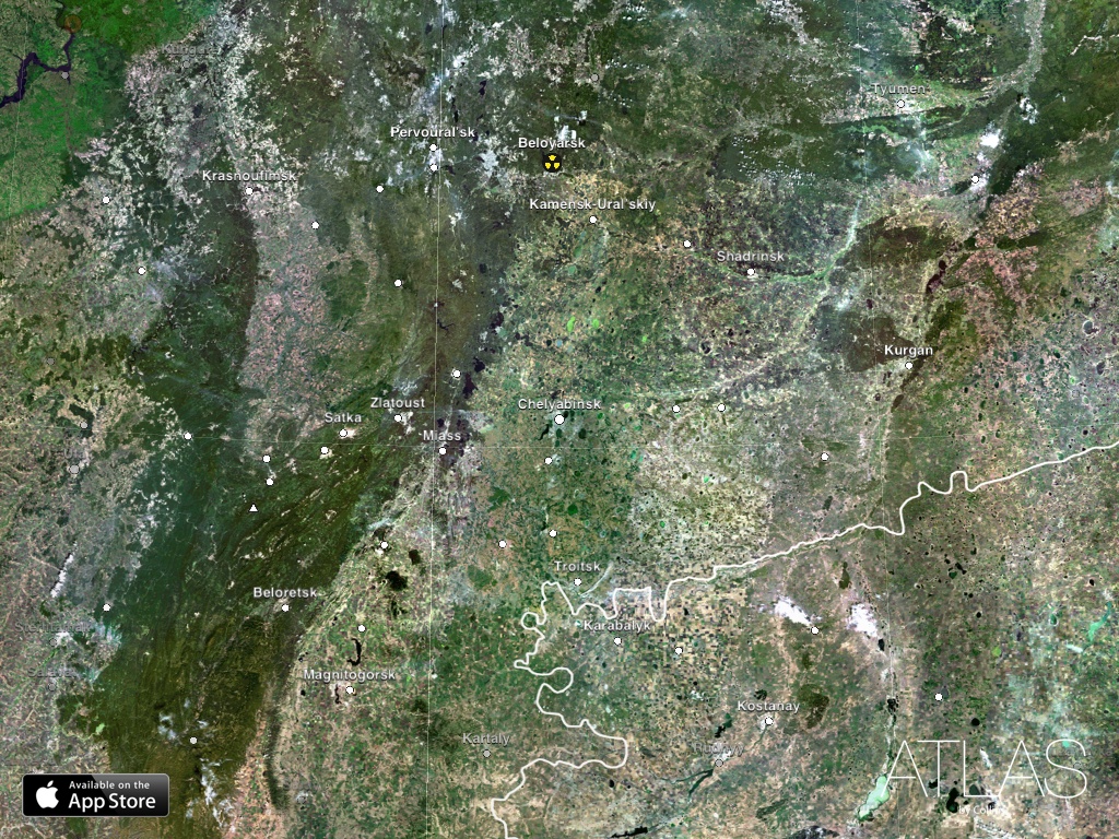
Sorry for the tiny resolution to fit that in 620 width. But you can click it to see the larger size. Image: Atlas by Collins.
But I knew they used to have more in that region so I did a quick search and, sure enough, near Ozyorsk is the old Mayak facility, site of one of the one of the worst nuclear accidents in history. It didn't have the big nuclear symbol on the energy map because it no longer produces energy, it is a nuclear waste treatment and storage facility now. Even though it had numerous accidents, the Soviets wisely never put it on their old maps either. If you know your American military history, Mayak was one of the things Gary Powers was photographing when his U-2 plane was shot down while flying a reconnaissance mission in 1960.
However, you can't escape modern satellites so inside the Collins Atlas I zoomed right in on both the Mayak site and the storage facility and there it is, about 45 miles away from Chelyabinsk. Luckily, the meteorite that did hit landed in a lake near Chebarkul, southwest of Chelyabinsk, rather than near Mayak. Still scary. And using this app is much safer than getting shot down by a Surface-to-Air Missile to get these pictures.
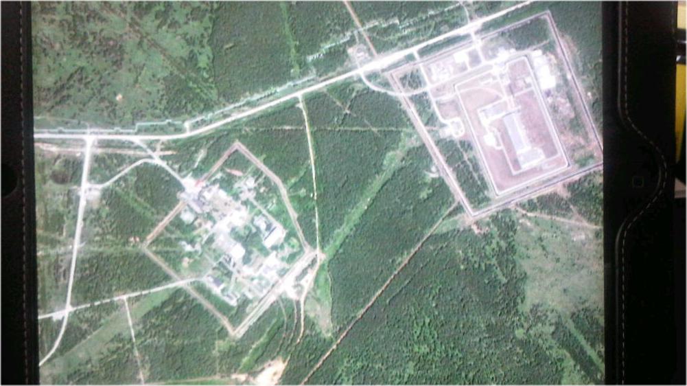
As you can see by comparing a picture of the screen to the iPad screenshot above, an ordinary camera does not do the map justice. This is the Mayak storage facility on the right and the processing on the left. Atlas by Collins.
I could have zoomed in even further but then I am just looking at a door on a building or whatever. It was so simple even I could do it, and I have never really used an iPad much prior to that. And the cost was only 7 bucks.
I can do some of that with Google Maps for free but I would have to know what I am looking for - and in this instance I didn't want to navigate, I wanted to see where things on a big scale are and put them in context and then examine further. Like you do with an Atlas.
Energy is not the only thing it does. The other maps have a lot more information available as well and they are overlayed. So if you want to look at cell-phone coverage to make sure you have enough of a signal to take pictures of an endangered species and post them up on Facebook, you can easily find both in the Atlas. You can't do that with Google Maps.
I'm kind of late to the party on this Atlas, it turns out - not using an iPad regularly will do that, I suppose. Techcrunch named it one of the 20 Best iOS Apps Of 2012 - so thanks, Mother Nature, for giving me a science reason to find a neat, new contextual tool.


Comments