Banner
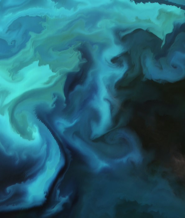
Encounters With Giant Sharks In The Arctic

It was one of these extremely rare days of calms seas far north in the world. When visiting the...

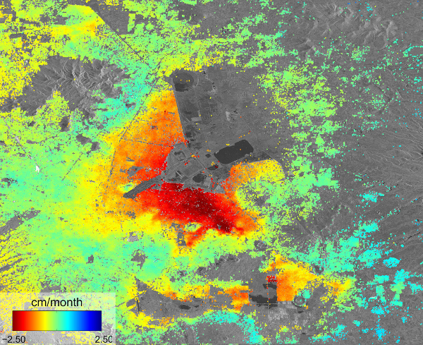
On Water And Subsidence In Mexico City

Mexico City has the best hotel shower ever. I am not one to spend a long time in the shower, but...

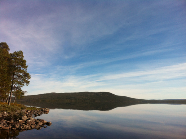
Citizen Science Then And Now. Want To Play The Game?

Our cabin is situated in one of the most remote places in Norway. My family got the place in the...

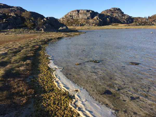
World Biodiversity Day: Wetlands, Biodiversity And The Role Of Earth Observations

It is somehow ingrained in my body, I think. The appreciation of biodiversity. I know I love wetlands...

User picture.
picture for Hank Campbellpicture for Tommaso Dorigopicture for Heidi Hendersonpicture for Sascha Vongehrpicture for Michael Whitepicture for Patrick Lockerby
Bente Lilja ByeRSS Feed of this column.

Earth science expert and astrophysicist writes about Earth observation, geodesy, climate change, geohazards, water cycle and other science related topics.

Today I do research and provide... Read More »

Blogroll
Credit: European Space Agency The fairing, which encapsulates the GOCE satellite, with the GOCE and Eurockot logos.
There is no reason to be surprised or shocked by the fact that the launch of GOCE suffer yet another delay. This time they are having some trouble with the launcher at the Plesetsk Cosmodrome in northern Russia where the action will take place, now presumably 27th October 2008. Shit happens. As long as we get this beauty of a satellite into orbit eventually, safe and sound, it is all fine and dandy by me.
GRACE & GOCE

GRACE & GOCE

Sep 30 2008 | comment(s)


A gravity model of the Earth constructed with data from GRACE. Credit: University of Texas Center for Space Research and NASA


It is all about gravity these days. First came GRACE (Gravity Recovery and Climate Experiment) and then we'll have GOCE (Gravity field and steady-state Ocean Circulation Explorer). I'll reveal the difference right away: GRACE measures time variations while GOCE measures the static gravity field. Both are equally important for a number of societal application and both are hot on the satellite scene this fall. Well, actually amazing science results have come out based on data from GRACE ever since it was launched in 2002. In particular the increased resolution is stunning and continue to enthuse the scientists. One of my colleagues, Srinivas Bettanpur at the University of Texas, has increased the spatial resolution beyond our wildest dreams and provides now researchers with an instrument that can estimate mass changes with a spatial resolution of less than 322 km (200 miles) – a lot better than first anticipated.

There is a lot of fuzz and even down right drama related to the forthcoming Large Hadron Collider experiment at CERN. I have started to call it the Lovely Hadron Collider because I think the science is great and I am a bad teaser...;-)
The Blue Marble by NASA/Reto Stöckli
Geodesy is the science of determining the geometry, gravitational field, and the rotation of the Earth and their evolution in time. I just want to confirm that the shape of the planet Earth will stay the same even after the Lovely Hadron Collider is fueled up and running.
Gravity field and steady-state Ocean Circulation Explorer - GOCE will be launched in a few weeks (10 September 2008). It is one of the biggest event within geodesy this year, hell probably in the history of geodesy. GOCE will improve our knowledge of this planet's gravity so that we eventually can all compare heights based on the same height reference system.
Height Reference System Modernization Natural Resources Canada has decided to improve their height reference system. This is the basis for both mapping and many other societal areas including climate change monitoring and science. Height Reference System Modernization (Height Modernization) is a transformative project at Natural Resources Canada for the development, implementation and promotion of a gravity-based height reference system for Canada. In other words, it is the realization of a new vertical datum for Canada by geoid modelling, rather than by geodetic levelling. This autumn ESA expect to finally launch GOCE, a satellite that will improve the gobal geoid subtantially.