Banner
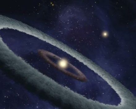
Betelgeuse, Gamow, and a Big Red Horse

There has been a lot of talk recently of Betelgeuse possibly going supernova this century or not...

Climate Change, the Walrus and the Carpenter

I have recently watched two videos on climate change by Sabine Hossenfelder.  The first one...

A Very Large Hadron Collider?

Frontpage image: Illustration of spherical explosion (kilonova) of two neutron stars (AT2017gfo/GW170817)...

User picture.
picture for Hank Campbellpicture for Hontas Farmerpicture for Sascha Vongehrpicture for Helen Barrattpicture for Patrick Lockerbypicture for Sean Gibbons
Robert H OlleyRSS Feed of this column.

Until recently, I worked in the Polymer Physics Group of the Physics Department at the University of Reading.

I would describe myself as a Polymer Morphologist. I am not an astronaut,

... Read More »

Blogroll
When I was a lad, we were taught that carbon had two allotropes, graphite and diamond.  Although they’re both covalently connected, in neither of these is there anything that one would regard as a ‘molecule’. 
Sniffer Rats

Sniffer Rats

Feb 24 2011 | comment(s)

CLICK HERE for some pictures showing how giant African pouched rats are being used to detect land mines and tuberculosis in Tanzania and Mozambique.

Their noses are very sensitive to TNT, and they are proving to be much easier to train than dogs.
A section of the people .... made capital out of their own ignorance.

When I read this I immediately thought of a certain British commentator who denies the anthropogenic contribution to climate change and has attracted a large following.


You may recognize the famous Russian composer Modest Mussorgsky, whose best known work is “Pictures at an Exhibition”.  But the pictures that follow are from a totally different exhibition, that of the Association for Science Education Annual Conference 2011, held at the University of Reading from 5th to 8th January.
 
When I were a lad (ay!) my father suggested that map projections was something I ought to interest myself in.  So I got hold of paper, ruler and pencil, drew a square grid, and then started filling in the outlines of the continents.  What emerged was something like this (maps like this are generated using this wonderful program from Brazil):


Now that wasn’t too good, was it?  Africa doesn’t look too bad, but Greenland’s horribly squashed, isn’t it?  So I borrowed some books from the library, and started to learn about all sorts of different projections.