

Most of the peaks are in the 2500-3000 meters of height above sea level, the tallest being mount "Marmolada", at 3342 meters. Despite being less tall than other mountain ridges in the Italian Alps, the Dolomites are reknowned for their breathtaking landscapes, as well as for the ski slopes they offer, especially -but not only- in the region around Cortina d'Ampezzo.
Being only a two-hour drive from Venice, where I live, I know a good part of the region fairly well, having hiked it several times alone and with friends. There is a maze of well-maintained paths that allow excursionists to get almost everywhere, as well as several dozen "vie ferrate", traced routes through the rock equipped with a permanent iron rope, which allow allow even non-experts to enjoy safe and breathtaking climbs.
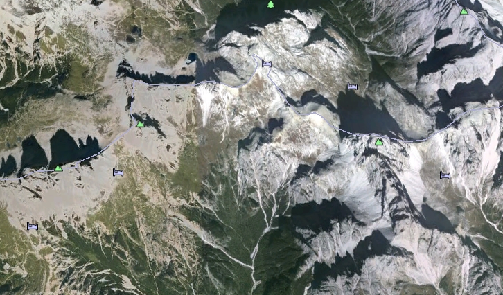
Last week I had a three-day hike with my fiancee and a friend in the "Dolomiti di Sesto", a set of mountains in the heart of the region (see Google Earth view above), where the landmark "Tre cime di Lavaredo" (a picture of these is shown below) are located. The path we followed was rather tiresome, especially on the first day:
Val Marson (1320 m. above sea level) -> Sella di Collarena (2530 m. above sea level) -> north side of Croda dei Toni (2200 m. above sea level) -> forcella Giralba (2450 m. above sea level) ->
Rifugio Carducci (2297 m. above sea level)
The above, which is a 15-km route with a total ascent of 1450 meters, took us the best part of the first day; the large amount of snow that had accumulated during the winter on the north face of the Croda dei Toni slowed us down quite a bit, because its crossing proved treacherous.
On the second day we left Rifugio Carducci toward Rifugio Comici, then Rifugio Pian de Cengia (2520 m above sea level), and finally to Rifugio Locatelli (2450 m above sea level), from where the famous view of the Tre Cime di Lavaredo can be enjoyed in full. Finally, on the third day we just had to climb down to the place where we had left our car.
Below are a few pictures I took along the route. If you love mountain trekking, I highly recommend a visit to the Dolomites !
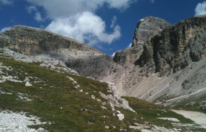
Above: the Croda dei Toni from the west side, walking up toward Sella di Collerena

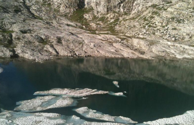
The Lago di Cengia
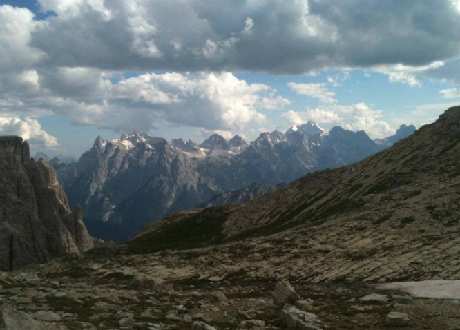
The south view from Sella di Collerena (m.2500 above sea level), looking at the Marmarole.
Monte Popera from the west
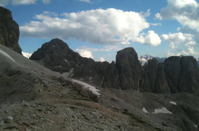
Sella di Collerena
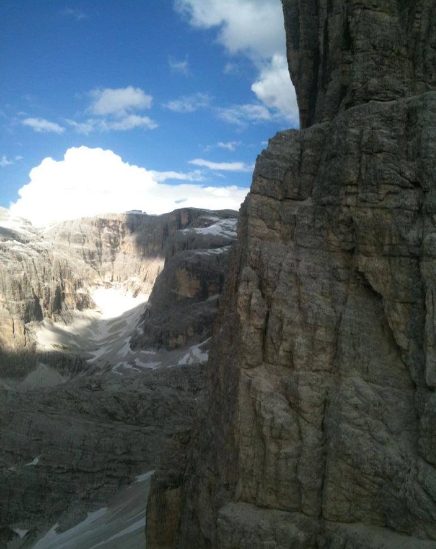
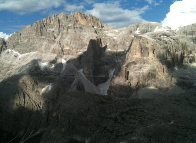
The north-west face of Croda dei Toni
The "lago ghiacciato" (iced lake), a beautiful lake close to Rifugio Carducci
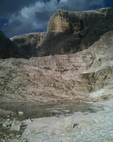
Lago ghiacciato and monte Popera

Sunset from Rifugio Carducci
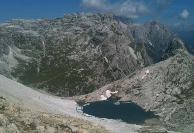
The lago ghiacciato looking north
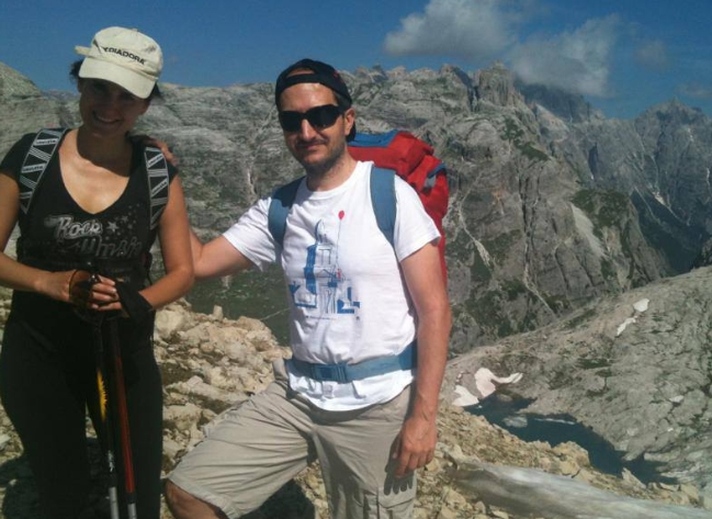
Kalliopi and I
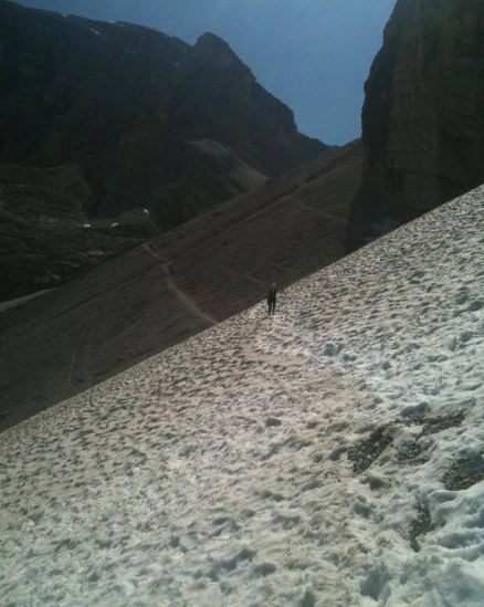
A treacherous spot on the north face of the Croda dei Toni
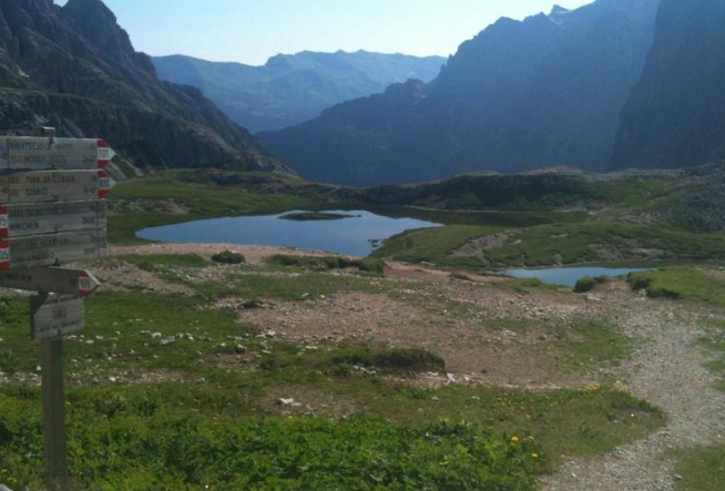
The Lago di Limo, looking north
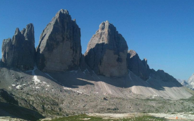
The wondeful north side of the Tre Cime di Lavaredo.


Comments